Lot 394
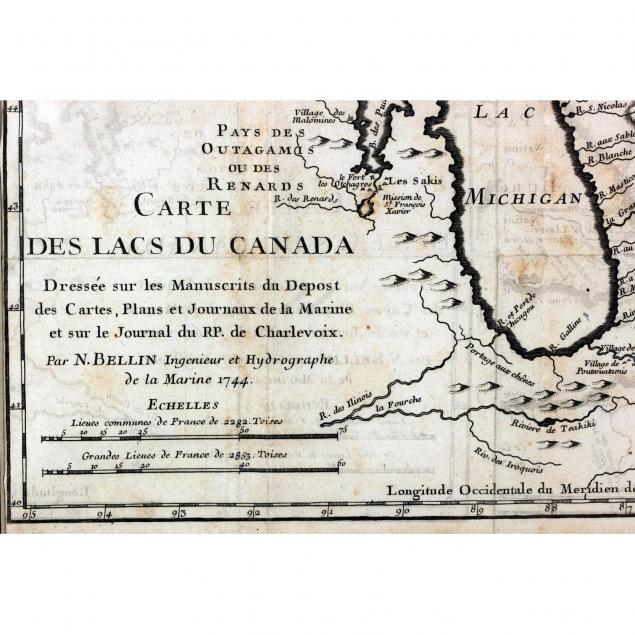
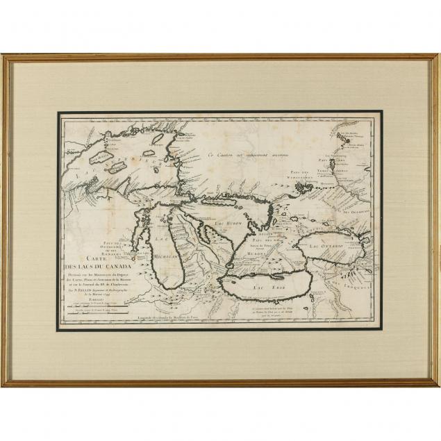
18th Century French Map of the Great Lakes
Lot Details & Additional Photographs
SS 11.75 x 17.75 in.; DOA 18.5 x 24.5 in.
The Collection of Arthur Bennett Schram, Jr. of Pinehurst, North Carolina and Jupiter Island, Florida
An early edition of this map, which was reprinted into the 1770s.
Ghostly ink transfer from another map; fold creases; a few marginal splits.
$200 - 400