Lot Details & Additional Photographs
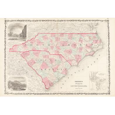
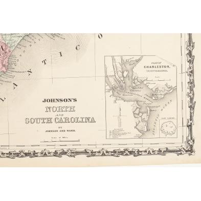
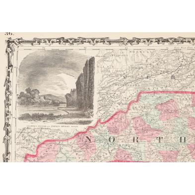
"Johnson's North and South Carolina," (New York: Johnson & Ward, ca. 1860s), hand colored steel engraving from folio, fine details showing the major roads and railroads, three insets include a map of Charleston Harbor, vignettes of Table Mountain, Chimney Rocks and French Broad River.
18 x 26.25 in.
Even toning,a few trivial spots.
$200 - 400