18th-century-french-map-of-the-eastern-seaboard
Lot 357
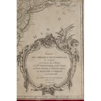
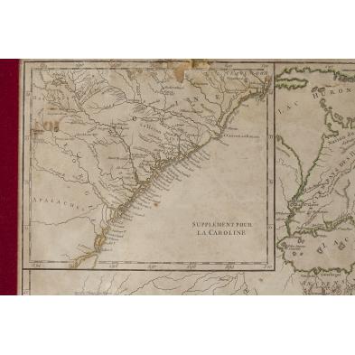
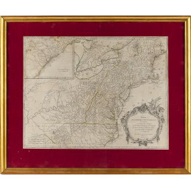
18th century French Map of the Eastern Seaboard
Lot Details & Additional Photographs
PARTIE DE L'AMERIQUE SPTENTRIONALE, QUI COMPREND LE COURS DE L'OHIO, LA NUE ANGLOTERRE, LA NUE YORK, LE NEW JERSEY, LA PENSYLVANIE, LE MARYLAND, LA VIRGINIE. LA CAROLINE, with supplemental inset of the South Carolina and Georgia coasts, by Robert Vaugondy, 1755. Presented behind a fabric mat in a modern wooden frame. Sheet 19.75 x 26 in.; DOA 27 x 32.5 in.

Estate of the late Elizabeth Niles Stevens and her daughter, Ann Buckner, Roads End Farm, Alamance County, North Carolina, (now Cedar Rock Park).

Some loss and creases along the upper edge; secured to the mat with strips of tape; overall even age toning with light areas of browning.

$300 - 500