Lot Details & Additional Photographs
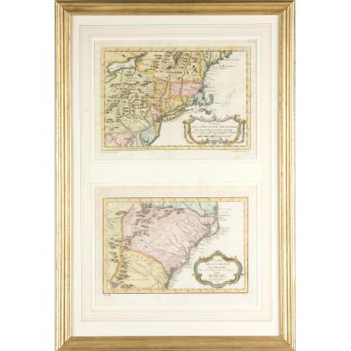
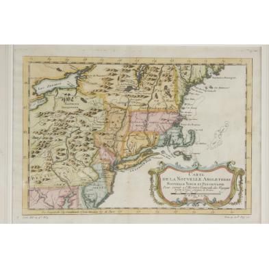
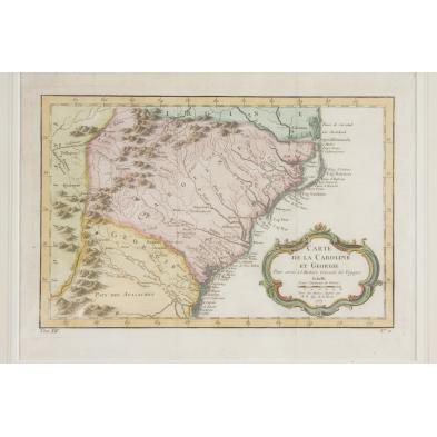
Both hand-colored engravings by J. Bellin, Paris, 1757; the first map "Carte De La Nouvelle Angleterre, Nouvelle Yorck et Pensilvanie," shows much of the Mid-Atlantic and New England regions. Sheet 10 x 13.5 in.; the second map, "Carte De La Caroline et Georgie," covers Southern Virginia to North Florida. Sheet 10.5 x 15 in. Both maps behind glass in gilt composition frame.
DOA 27 x 18 in.
A few light stains, browning on edges.
$300 - 500