Lot Details & Additional Photographs
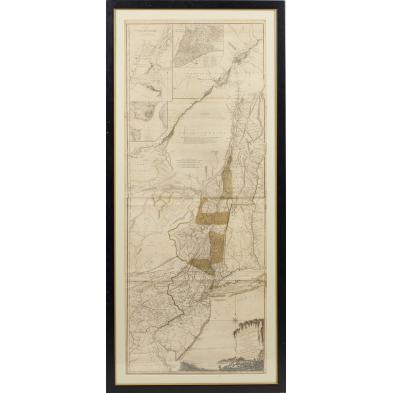
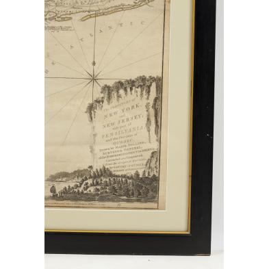
A copperplate engraving from THE AMERICAN ATLAS by Thomas Jeffreys (London: Sayler and Bennett, 1776), "The Provinces of NEW YORK, and NEW JERSEY; with part of PENSILVANIA, and the Province of QUEBEC. Drawn by Major Holland, Surveyor General, of the Northern District in America. Corrected and Improved from the Original Materials, by Governr Pownall, Member of Parliament, 1776," also shown is western New England plus inset maps "Mouth of Hudson's River," "A Plan of the City of New York," and "A Plan of Amboy with its Environs," original hand-colored outlines. A late state impression wherein Jeffreys' name is omitted. Professionally placed behind mat in a custom plain wooden frame. (Sheet 54.25 x 21.5 in.; DOA 59 x 26.75 in.). The Jeffreys maps of North America were widely used by British officers during the Revolutionary War.
Toned paper with slight browning to the edges; old paper and tape reinforcement along the back's lower edge; two small areas of verso pencil notations. An original map that is not laid down and remains quite presentable.
$1,000 - 2,000