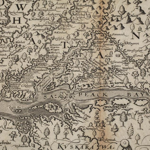
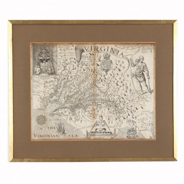
a-17th-century-state-9-edition-of-john-smith-s-virginia-map
Lot 341
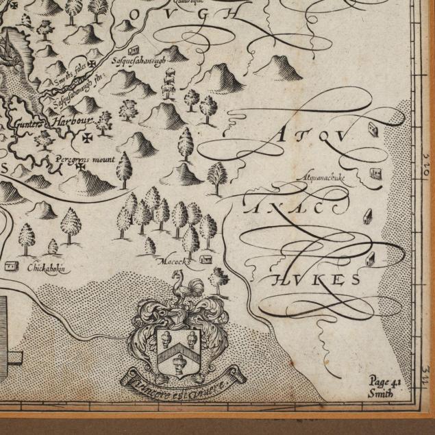
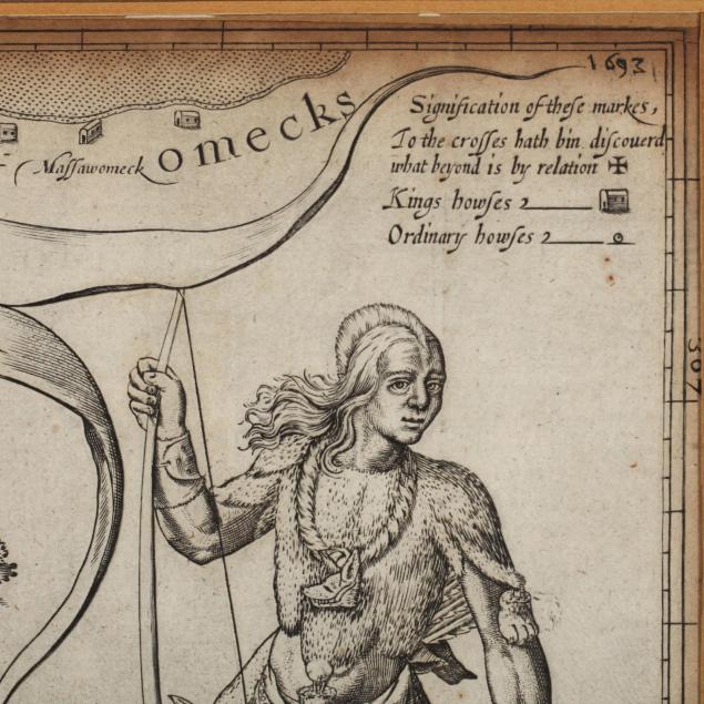
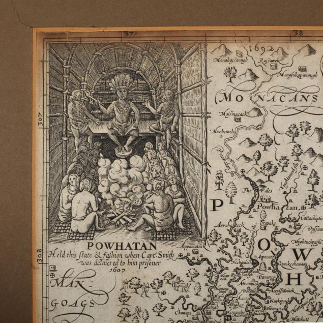
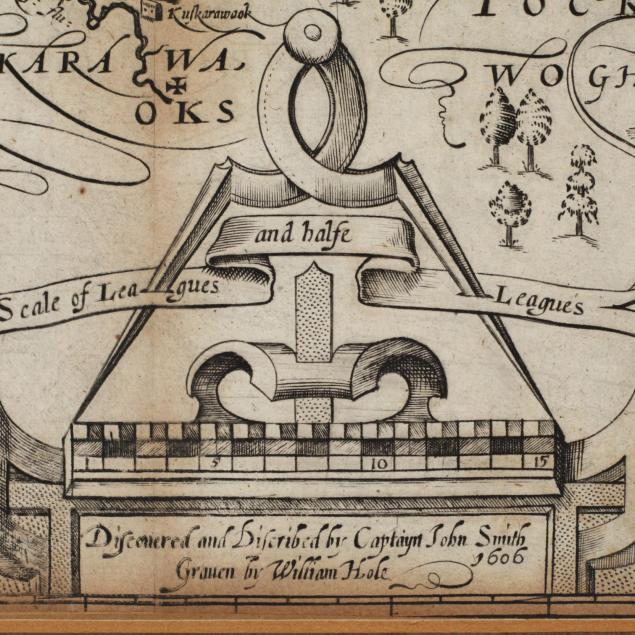
A 17th Century State 9 Edition of John Smith's Virginia Map
Lot Details & Additional Photographs
Virginia. Discovered and Discribed by Captayn John Smith. as inserted in Purchas His Pilgrims, book 9, volume 4 (London: William Stansby for Henrie Featherstone, 1625). This map has the State 8 additions of the place names "Feathersones Ba ye," "Bollers bush," and Sparkes Poynt" plus "Page. 41/Smith" in the lower right corner; State 9 diagnostics present include the extended "A" in Appamatuck and the addition of "Washebonne C." above the ship offshore. Presented in a later gilt frame.

SS 16 3/16 x 12 11/16 in.; DOA in frame 18.5 x 22 in.

From the collection of the late Brien E. Kehoe, Washington, D.C.

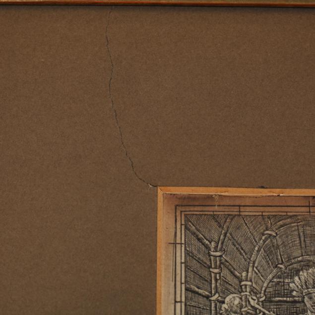
Laid down to board below and mat above; extent of trimming not known, however plate appears to be complete; browning along central vertical fold; light overall aging; frame with no glass and losses to gilt.

$1,000 - 3,000