Lot 1019
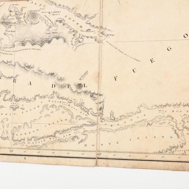
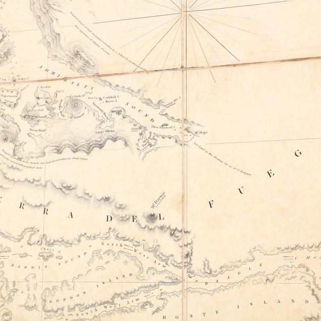
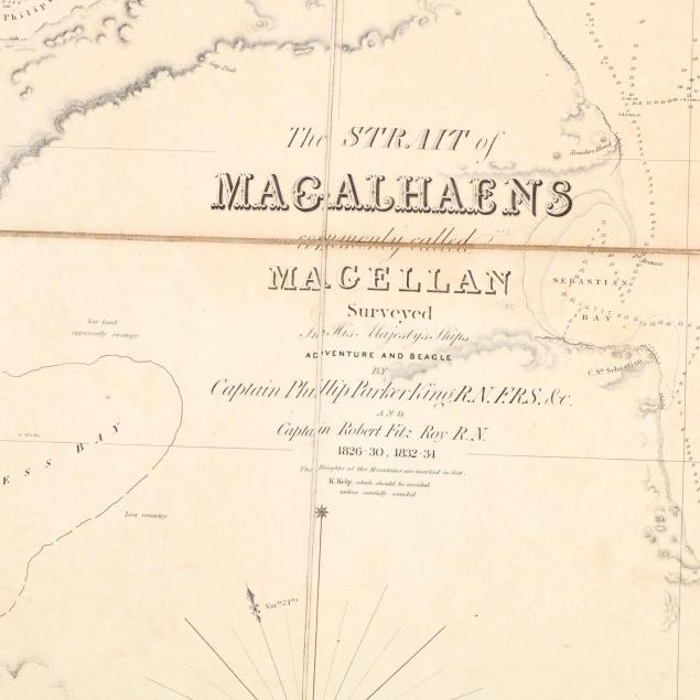
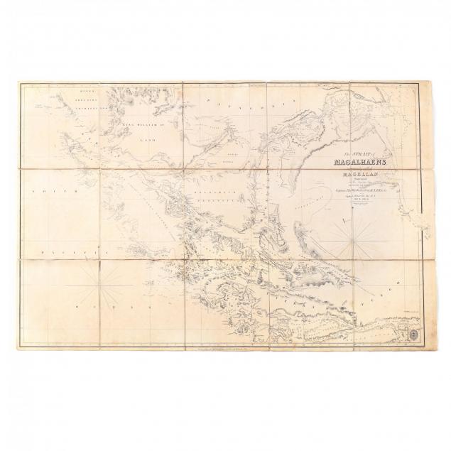
Extremely Rare British Admiralty Map Surveyed During Darwin's Expedition
Lot Details & Additional Photographs
This revision of the original 1832 map boldly credits Captain Fitz Roy's celebrated 1832-1834 expedition on the HMS Beagle, which has become famous through its close association with the young Charles Darwin.
Full Sheet 25.25 x 38 9/16 in.
The Lifelong Collection of Keith and Caroline Gray, Charlotte, NC. Keith and Caroline Gray were passionate about antiques, art, and history. Together they attended antique shows and auctions for decades – assembling a collection particularly strong on American coin silver, Asian art, historical documents, early images, and English ceramics. Both were longtime supporters of the Mint Museum in Charlotte, with Caroline serving in multiple capacities from docent to a member of the acquisitions board and trustee. Caroline translated her love of material culture into a successful career, becoming a certified property appraiser in Charlotte.
Some small splits to the linen; the paper with overall age toning and subtle stains.