Auctions
Results
Sell
About
Home
·
November Gallery Auction · Nov 17, 2018 09:00am
Lot 1143
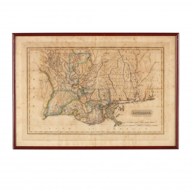
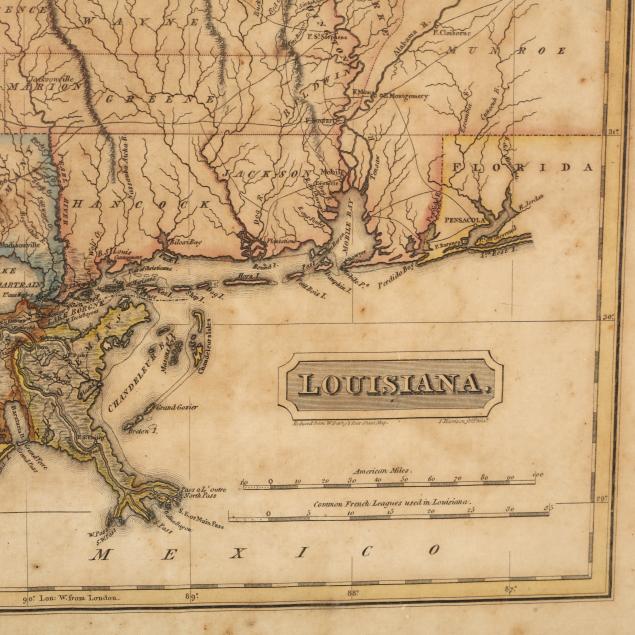
Early 19th Century Map of Louisiana
Lot Details & Additional Photographs
(Baltimore: F. Lucas, 1817), engraving with outline color, depicts adjacent areas in Mississippi, Alabama, Florida, Texas and Arkansas (being labeled "Missouri"). Presented in a plain wooden frame.
DOA 14.5 x 20 5/8 in.
From the Estate of Richard & Ida Simpson, Chapel Hill, NC
Foxing; overall age toning; not examined out of the frame.