Auctions
Results
Sell
About
Home
·
19th Annual New Year's Auction · Jan 5, 2019 09:00am
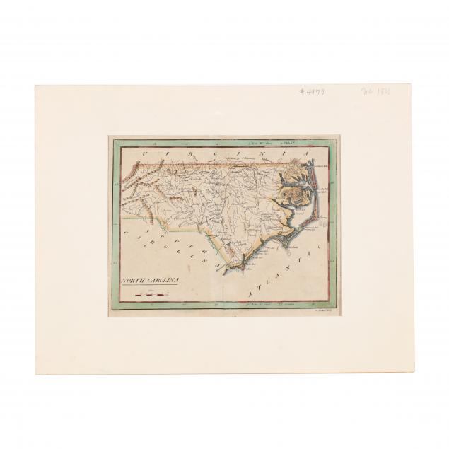
Lot 379
Very Early Map of North Carolina
Lot Details & Additional Photographs
From
American Pocket Atlas
(Philadelphia: Matthew Carey, 1801), copperplate engraving by W. Barker, with outline color. Presented behind a mat.
Sheet 8 x 9 in.
Split to lower left corner; some browning.