Auctions
Results
Sell
About
Home
·
Important Spring Auction · Mar 2, 2019 10:00am
Lot 1227
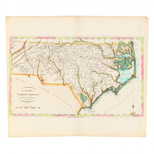
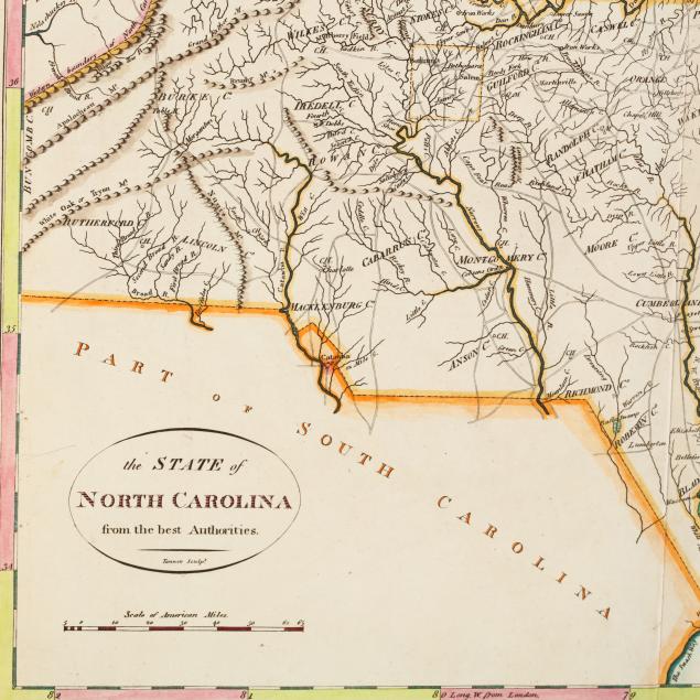
Late 18th Century Map of North Carolina
Lot Details & Additional Photographs
The State of North Carolina from the best Authorities
from the
American Atlas
(New York: John Reid, 1796), copperplate engraving by Benjamin Turner with hand-coloring. Behind mat, unframed.
Plate 11 x 18.5 in.; Sheet 16.75 x 19 in.
From a private North Carolina collection
Light browning to the edges, else fine condition.
$400 - 600