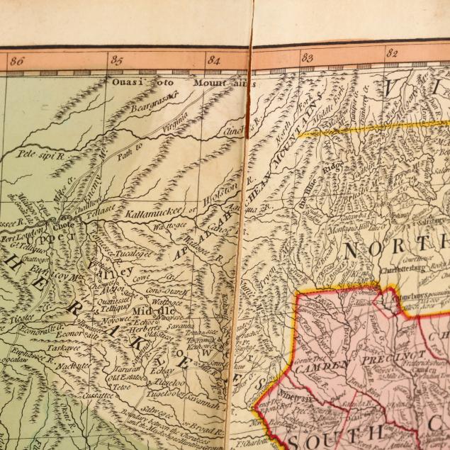
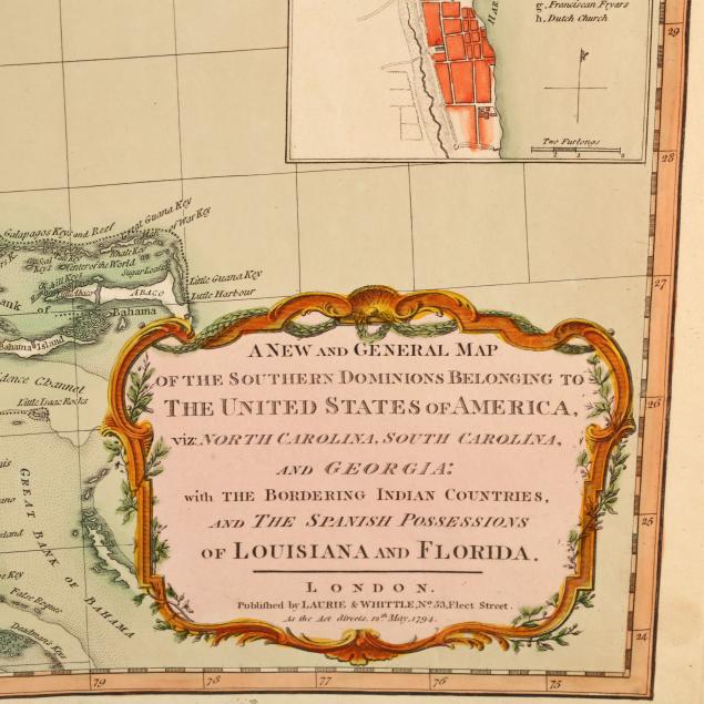
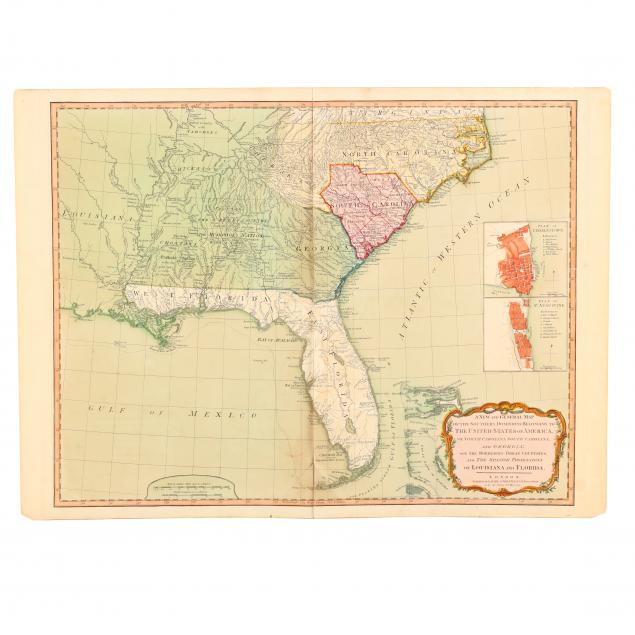
late-18th-century-map-of-the-southeastern-united-states
Lot 1232
Late 18th Century Map of the Southeastern United States
Lot Details & Additional Photographs
A New and General Map of the Southern Dominions Belonging to the United States of America, viz: North Carolina, South Carolina, and Georgia: with the Bordering Indian Countries, and the Spanish Possessions of Louisiana and Florida (London: Laurie & Whittle, 1794), copperplate engraving with color, composed of two sheets, includes inset maps of Charleston and St. Augustine. Behind mat, unframed.

Plate 19.75 x 25.25 in.; Sheet 20.75 x 28.25 in.

From a private North Carolina collection

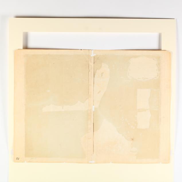
Overall light toning; two inch split from right edge; a 1.5 inch diagonal split from a one inch strip of loss along central fold above Florida keys; small amount of tape reinforcement en verso. Good condition.

$500 - 1,000