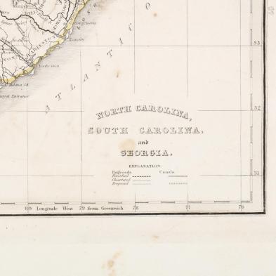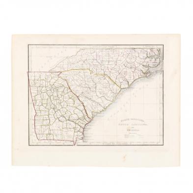
Lot 778
Anonymous Mid-19th Century Map of the Carolinas and Georgia
Lot Details & Additional Photographs
Plate 8 x 10.5 in.; Sheet 10.5 x 13 in.
From a private North Carolina collection
Light aging; tiny area of surface loss over Charlotte.