Lot 512
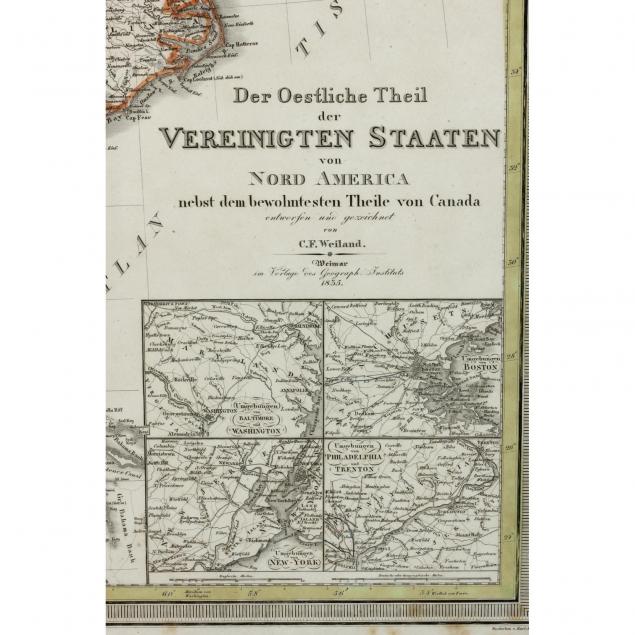
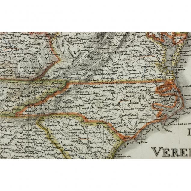
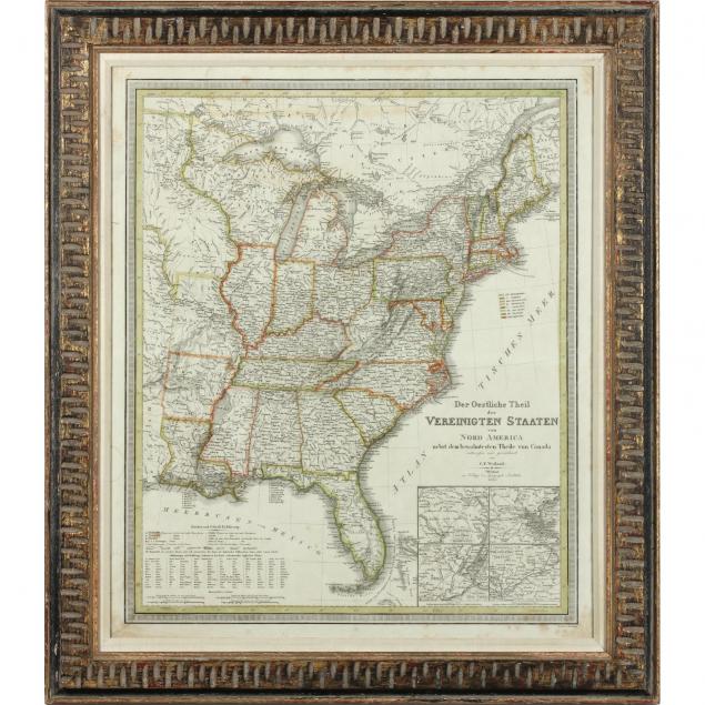
Early German Map of the Eastern United States
Explore more items like this one.
Visit our Prints, Multiples & Photographs Department Prints, Multiples & Photographs
Lot Details & Additional Photographs
DOA 31.5 x 27.5 in.
The Private Collection of a Lady
Not examined out of the frame; appears to be in fine condition.
$200 - 400