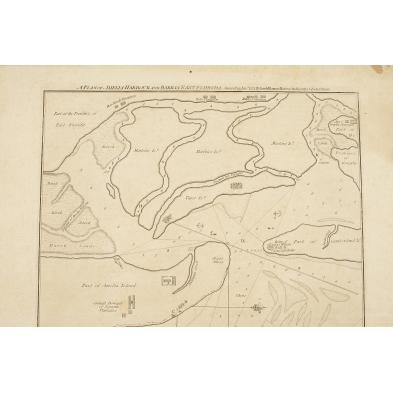
Lot 533
18th Century Amelia Island Nautical Chart
Explore more items like this one.
Visit our Prints, Multiples & Photographs Department Prints, Multiples & Photographs
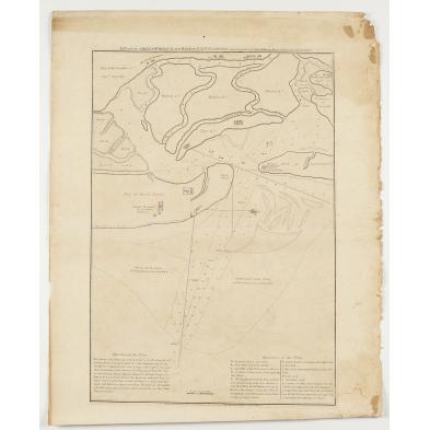
Lot Details & Additional Photographs
28.5 x 21.5 in.
A good impression that would display well in a frame behind a mat; very light foxing throughout; browning and minor loss to the edges; the lower right corner with a 3 in. split; the bottom edge folded under.
$800 - 1,200