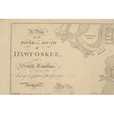
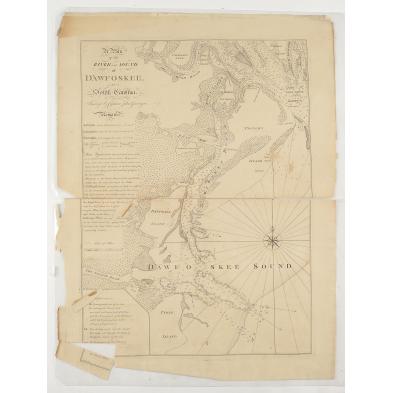
rare-18th-century-south-carolina-nautical-chart
Lot 536
Rare 18th Century South Carolina Nautical Chart
Lot Details & Additional Photographs
Monochrome copperplate engraving, A PLAN OF THE RIVER AND SOUND OF D'AWFOSKEE IN SOUTH CAROLINA SURVEY'D BY CAPATAIN JOHN GASCOIGNE (London: Jefferys and Faden,1776), showing the waterways between Port Royal, South Carolina and Tybee Island, Georgia. Today's Hilton Head Island, here "Trench's Island", and Daufuskie Island are prominent landmarks near the center of the chart. Coastal South Carolina was the Southern seat of the American Revolution until the British captured Charleston in 1780. Copies of this map were no doubt used by combatants fighting for control of the wealthy and vital Low Country. The publisher's information

29.25 x 22 in.

Separation of upper and lower halves; lower left corner separated, but present; moderate edge chipping and browning; publisher's line below the chart did not transfer from the plate and is an indistinct blur of ink. Worthy of restoration with great display potential.

$600 - 900