Lot 537
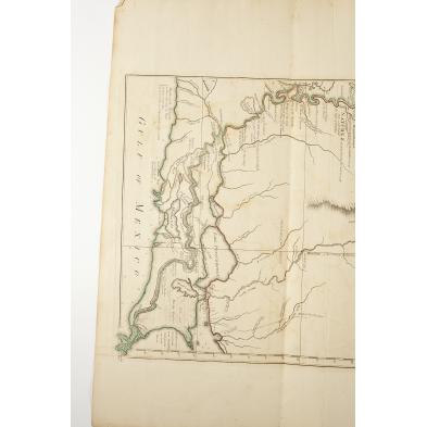
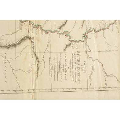
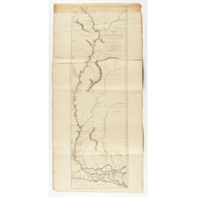
18th Century Ross Map of the Mississippi River
Explore more items like this one.
Visit our Prints, Multiples & Photographs Department Prints, Multiples & Photographs
Lot Details & Additional Photographs
46.25 x 21.5 in.
Browning to top and side edges; minor chipping and a few small splits to edges; crease to lower left corner; a strong impression retaining vibrant color.
$1,000 - 2,000