Lot 355
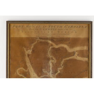
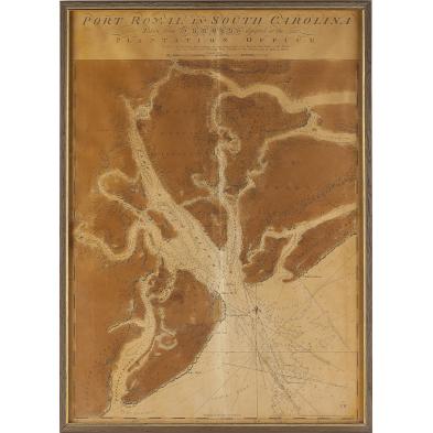
18th Century British Naval Map of Port Royal, SC
Explore more items like this one.
Visit our Prints, Multiples & Photographs Department Prints, Multiples & Photographs
Lot Details & Additional Photographs
Estate of the late Elizabeth Niles Stevens and her daughter, Ann Buckner, Roads End Farm, Alamance County, North Carolina, (now Cedar Rock Park).
Old tape residue on back along the horizontal central fold with 2 in. strip of masking tape from the bottom margin; heavy browning from acid transfer; clean edges.
$1,500 - 2,500