Lot 356
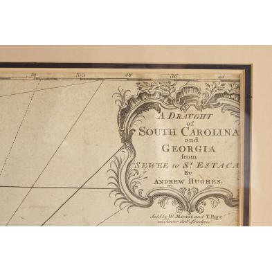
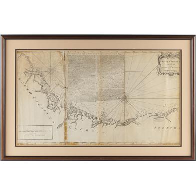
Rare Hughes Map of the Southeastern Coast
Explore more items like this one.
Visit our Prints, Multiples & Photographs Department Prints, Multiples & Photographs
Lot Details & Additional Photographs
Estate of the late Elizabeth Niles Stevens and her daughter, Ann Buckner, Roads End Farm, Alamance County, North Carolina, (now Cedar Rock Park).
Secured to mat by strips of tape; creases to left edge; peripheral browning on all sides; areas of loss along the first fold and in the upper corners; spots of old archival tape on back; pencil notation on back.
$1,000 - 2,000