Lot Details & Additional Photographs
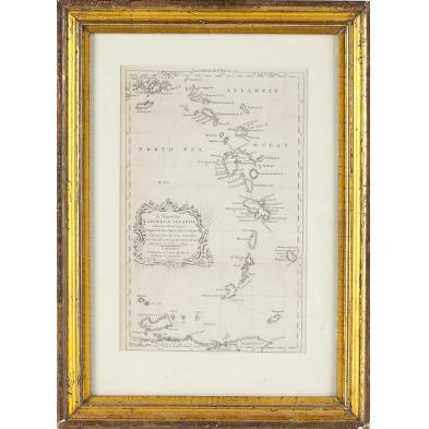
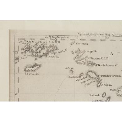
Titled A MAP OF THE CARIBBEE ISLANDS; SHEWING WHICH BELONG TO ENGLAND, FRANCE, SPAIN, DUTCH & DANES; BY THOS. JEFFRYS, GEOGRAPHER TO HIS ROYAL HIGHNESS THE PRINCE OF WALES, originally a fold-out removed from the August, 1756 issue of "The Gentleman's Magazine." Presented in an antique gilt composition frame.
SS 8.5 x 13.25 in.; DOA 20 x 14.5 in.
Fold creases; not examined out of the frame.
$100 - 200