Lot 288
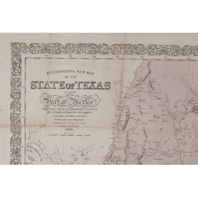
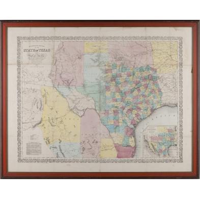
Richardson's New Map of the State of Texas, 1860
Explore more items like this one.
Visit our Prints, Multiples & Photographs Department Prints, Multiples & Photographs
Lot Details & Additional Photographs
28.5 x 36.25 in.
Collection of the late John Earl Jones, Greenville, South Carolina
A rare and attractive map that was issued annually through 1861, when it was suspended due to the outbreak of the Civil War.
Laid down to a board; marginal damp stains; pinholes of loss at some fold intersections; old tape residue to right edge.
$500 - 1,000