Lot 622
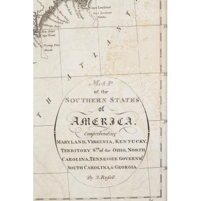
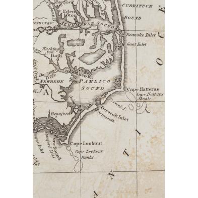
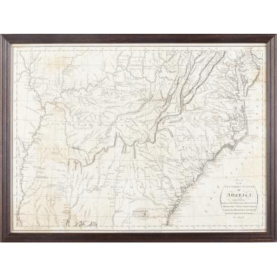
18th c. "Map of the Southern States of America,"
Explore more items like this one.
Visit our Prints, Multiples & Photographs Department Prints, Multiples & Photographs
Lot Details & Additional Photographs
DOA 16 x 21.25 in.
Deaccessioned from MESDA
Not examined out of the frame; light foxing throughout.
$200 - 400