Lot Details & Additional Photographs
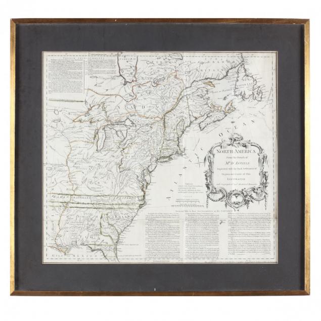
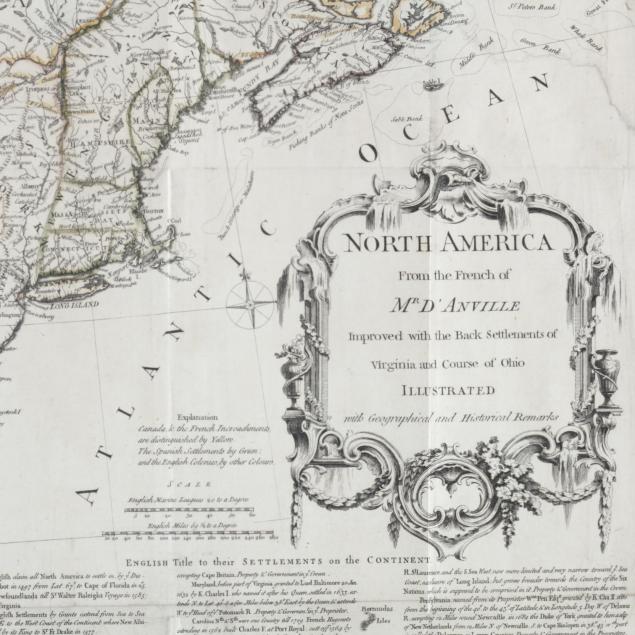
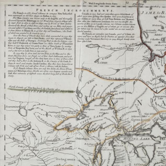
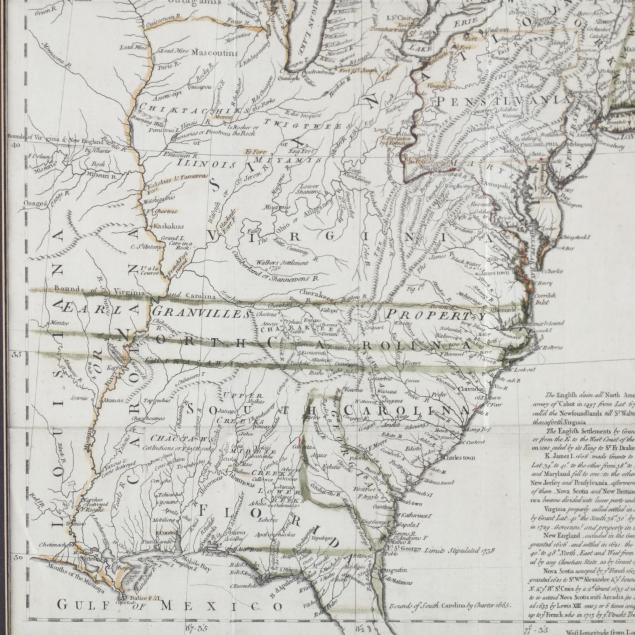
North America From the French of Mr D'Anville Improved with the Back Settlements of Virginia and Course of Ohio (London, 1755), copperplate engraving with outline color, the text of this French and Indian War era map describes irritating "French Incroachments" and clearly outlines "English Title to their Settlements on the Continent." Prominent Indian nations from Canada to the Gulf of Mexico are also shown. As to "incroachments," "Lord Granville's Property" extends from North Carolina clear across the Mississippi River into French Louisiana. Presented in a gilt wooden frame.
Sheet 18.5 x 21.25 in.; DOA in frame 23.5 x 25.5 in.
From the collection of the late Brien E. Kehoe, Washington, D.C. Trimmed to the plate along half of one edge; fold creases.
$300 - 600