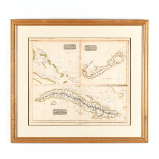
Lot 100
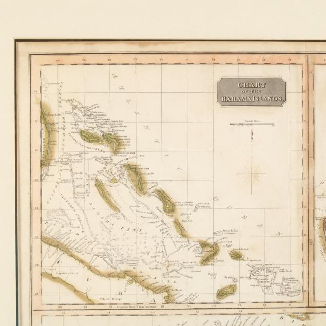
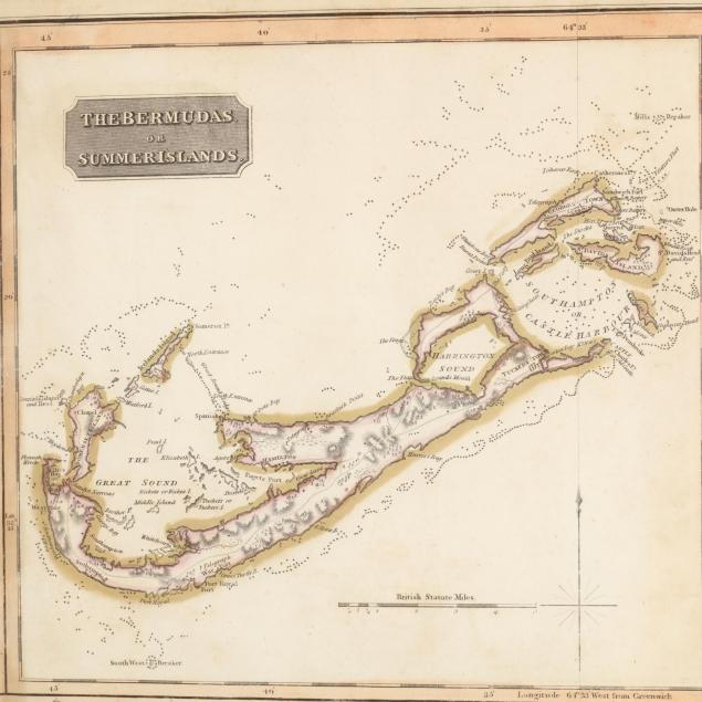
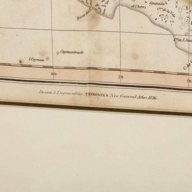
Early 19th Century English Map of Caribbean and Atlantic Islands
Explore more items like this one.
Visit our Historical Department Historical
Lot Details & Additional Photographs
DOA 29.75 x 33.25 in.
The Estate of William Lee Pritchard, M.D., Charlotte, NC
Light soiling, else very good condition.