seutter-matthaus-i-mappa-geographica-regionem-mexicanam-et-floridam-i
Lot 766
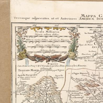
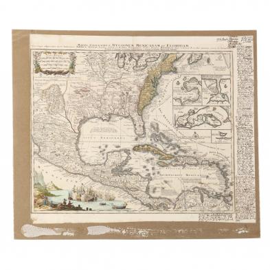
Seutter, Matthaus. Mappa Geographica Regionem Mexicanam et Floridam...
Lot Details & Additional Photographs
(Augsburg, circa 1740), copperplate engraving by Tobias Conrad Lotter with hand coloring, depicting much of North America, the Caribbean, Central America and part of South America; included is a distance scale, sea battle vignette, and four insets showing ports; the right margin is given to extensive late 18th century and very early 19th century manuscript notations that appear to be in Dutch.

From a private North Carolina collection

This map is extensively trimmed and laid to a piece of modern chipboard.