late-18th-century-british-map-of-the-caribbean-and-adjacent-lands
Lot 767
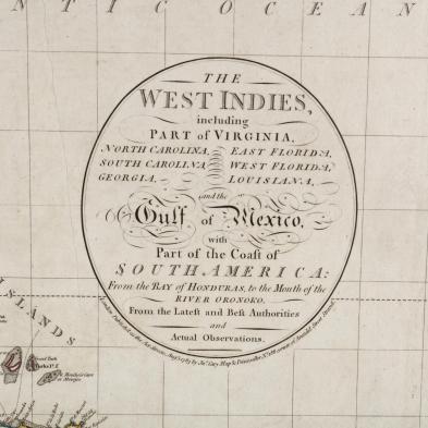
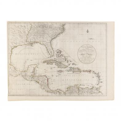
Late 18th Century British Map of the Caribbean and Adjacent Lands
Lot Details & Additional Photographs
The West Indies including Part of Virginia, North Carolina, South Carolina, Georgia, East Florida, West Florida, Louisiana and the Gulf of Mexico, with Part of the Coast of South America: from the Bay of Honduras, to the Mouth of the River Oronoko. (London: John Cary, 1783), copperplate engraving with outline color, period manuscript "West Indies" en verso. Behind mat, unframed.

Sheet 24.75 x 31 in.; Plate 22.75 x 28.75 in.

From a private North Carolina collection

Small 1 in. split to right margin, else fine condition.