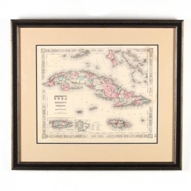
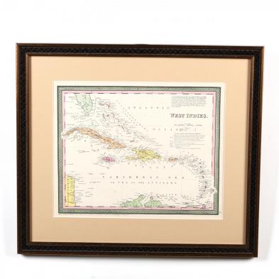
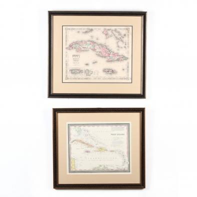
two-19th-century-maps-of-cuba-and-adjacent-areas
Lot 668
Two 19th Century Maps of Cuba and Adjacent Areas
Lot Details & Additional Photographs
To include: West Indies (Philadelphia: Thomas, Cowperwait & Co., 1850), plate 39 from atlas, presented behind mat in wooden frame with gilt (DOA 20.25 x 23 in.) and Johnson's Cuba, Jamaica and Porto Rico (New York: Johnson & Ward, 1863), plate 62 from atlas, presented behind mat in silvertone wooden frame (DOA 21.5 x 24.5 in.).

Both maps with clean, very good appearance; not examined out of frames.