Lot 183
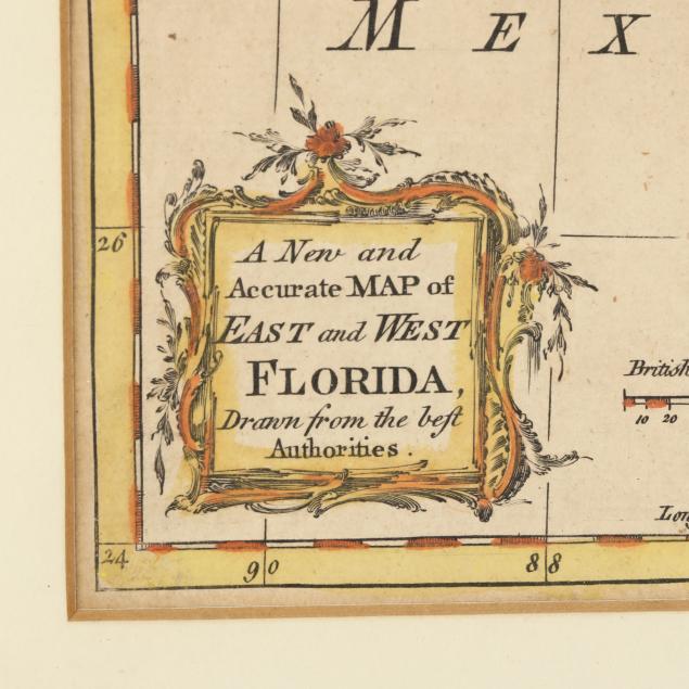
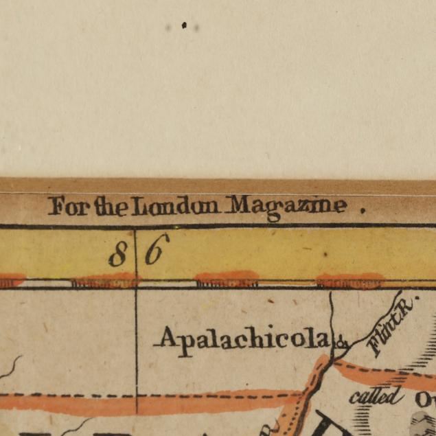
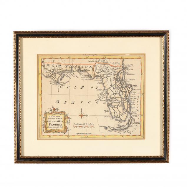
Mid-18th Century Map of Florida
Explore more items like this one.
Visit our Historical Department Historical
Lot Details & Additional Photographs
Sight size 10.25 x 12in; Frame Dimensions 11 x 13 in.
Trimmed and laid to a second sheet, likely original; even age toning; very good condition.