Lot 2267
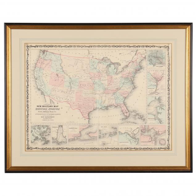
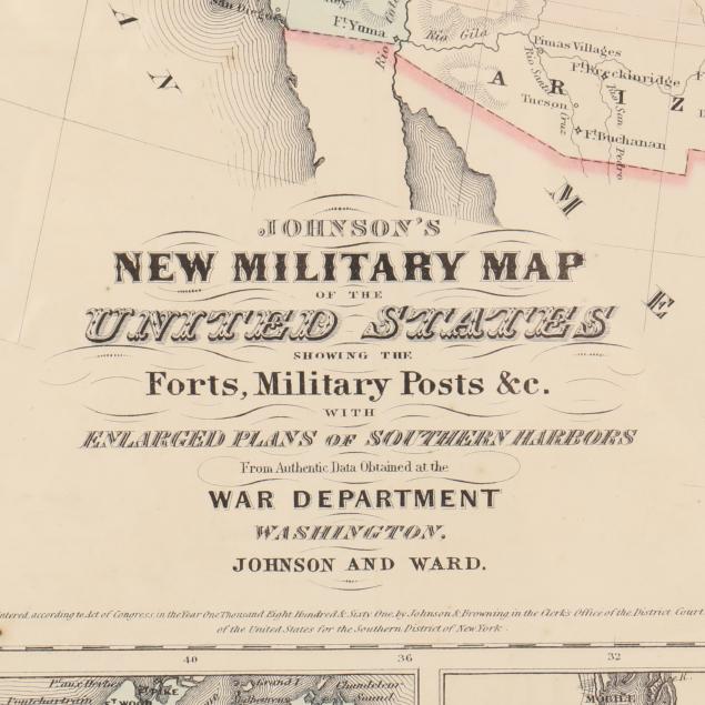
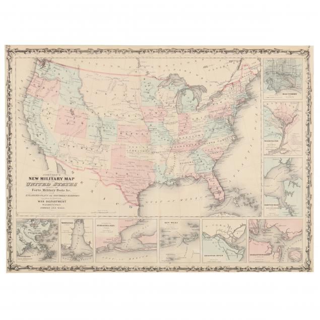
Johnson's New Military Map of the United States...
Explore more items like this one.
Visit our Historical Department Historical
Lot Details & Additional Photographs
Sight size 17-1/2 x 24-1/8 in.; Frame dimensions 24-3/8 x 30-3/4 in.
Ex. Virginia Private Collection
Central vertical fold as made; clean with even light age toning; not examined out of the frame.