Lot 2268
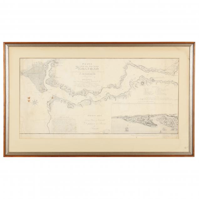
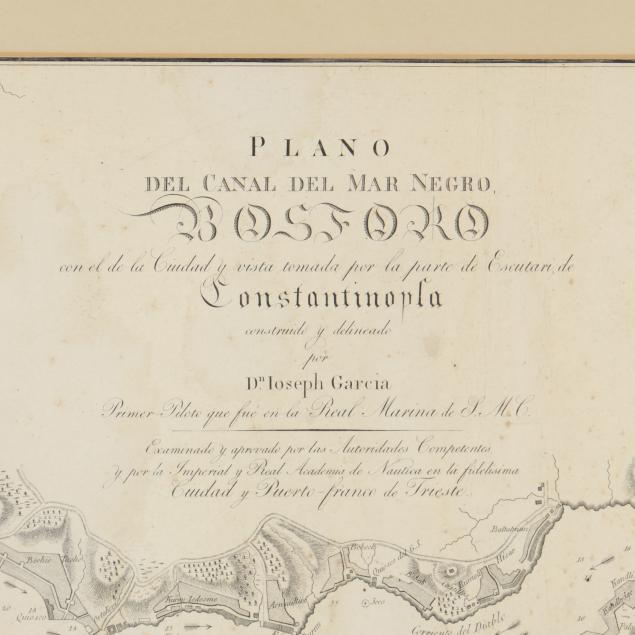
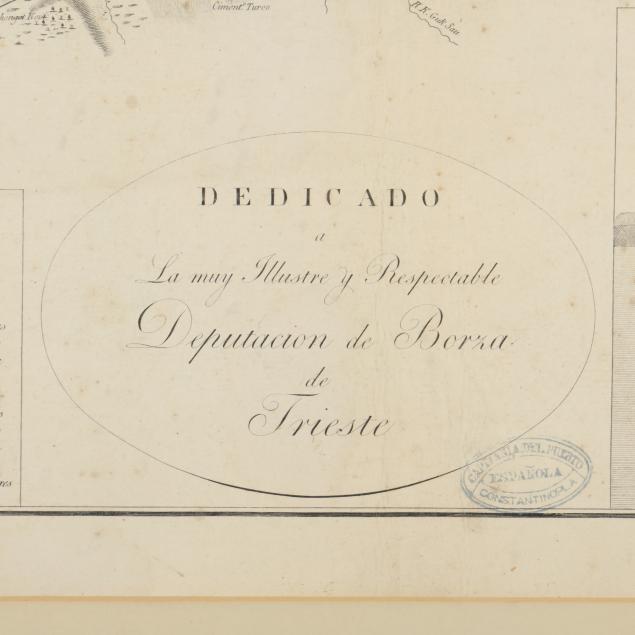
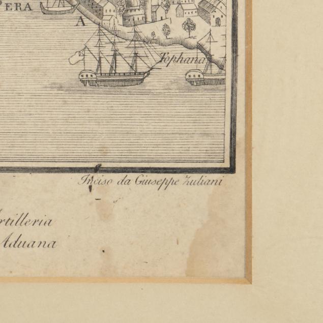
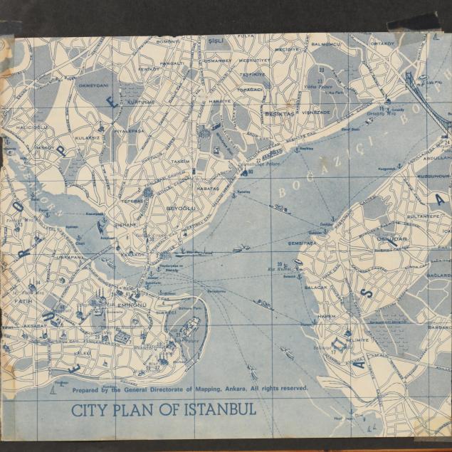
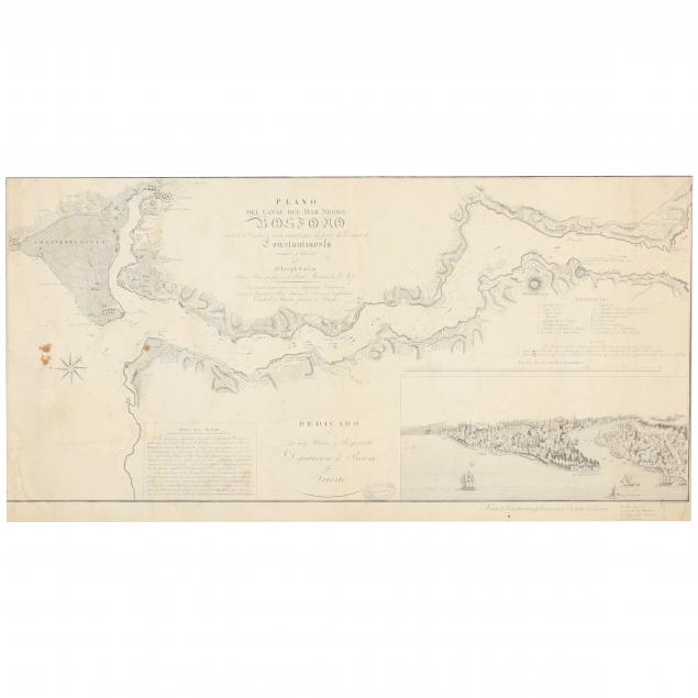
Napoleonic Era Spanish Navigation Chart for the Bosphorus
Explore more items like this one.
Visit our Historical Department Historical
Lot Details & Additional Photographs
Sight size 16-3/4 x 33-1/4 in.; Frame dimensions 24 x 40 in.
From the Estate of Nancy Palmer and Bruce Wardropper, Durham, North Carolina
Overall age toning with light stains; the sheet laid down, likely in the 1960s.