Lot 3085
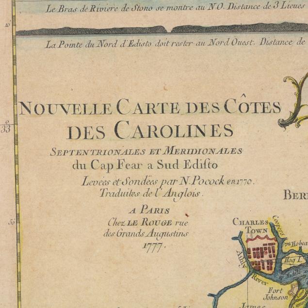
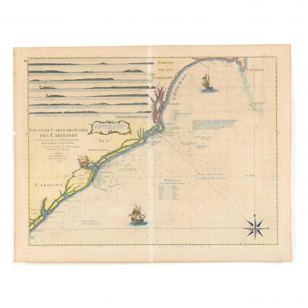
Le Rouge Sea Chart of the Carolina Coast From Cape Fear to South Edisto
Explore more items like this one.
Visit our Historical Department Historical
Lot Details & Additional Photographs
From the Estate of the late Thomas and Pamela Wright, Delaware and New York
This map was extremely useful to navies plying the Southeastern coast during the American Revolution.
Even age toning overall with some browning to extremities; small chip to left edge; vertical fold; very good condition.