russell-john-i-north-america-drawn-from-the-best-authorities-i
Lot 622
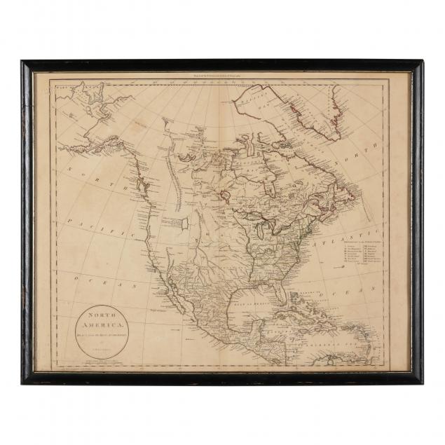
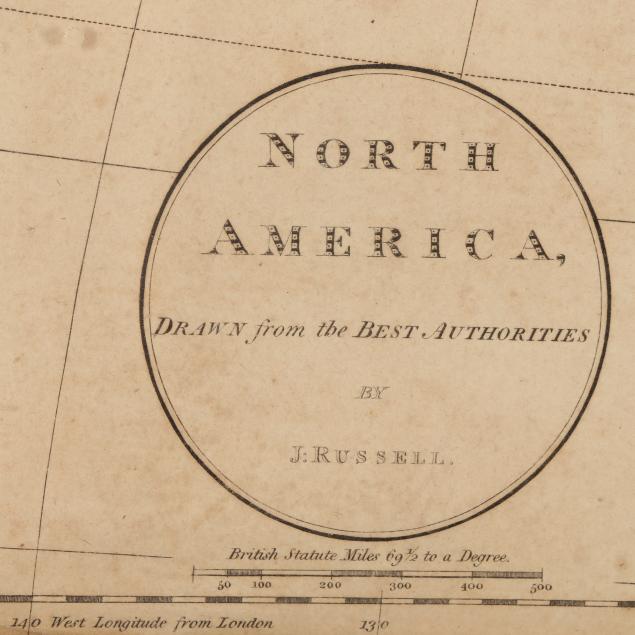
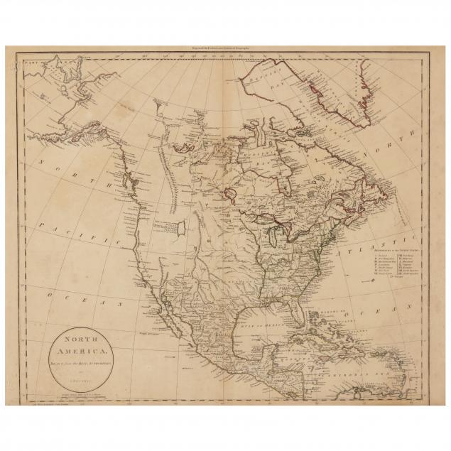
Russell, John. North America Drawn from the Best Authorities
Lot Details & Additional Photographs
London, circa 1801 -1811, copperplate engraving with outline color, the upper margin imprinted "Engraved for Guthries New System of Geography," the map itself shows the enormous region between the Caribbean and Alaska's Bering Straight; North America east of the Mississippi River, all of Mexico, and points further south are shown in great detail, whereas the western regions are largely empty all the way to the Pacific; the upper right corner of the back is inscribed in a 20th century hand with "Russell 1801" while number "8" appears in the vicinity as a watermark. The map is in a 1960s wooden frame with a paper backing that should be replaced.

Sheet size 17 x 21-1/2 in. overall

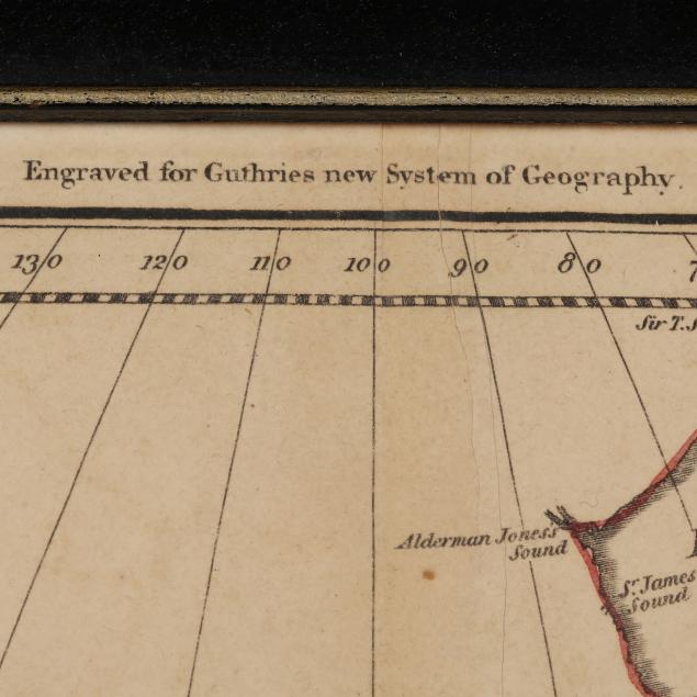
The lower margin having publisher's information is trimmed away; the other three margins are folded in so as to accommodate the frame; the toned paper has non-archival paper between it and the frame and should be set against an acid-free surface; overall, save the trimming, the sheet is in good condition.