Lot 2054
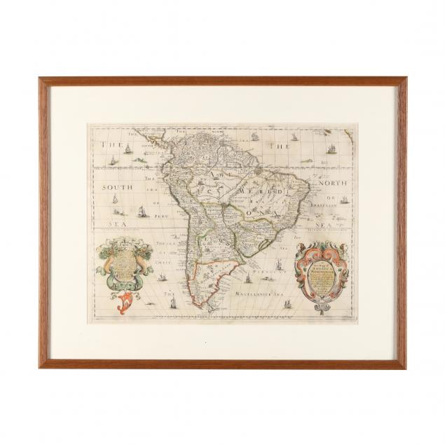
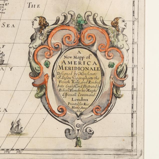
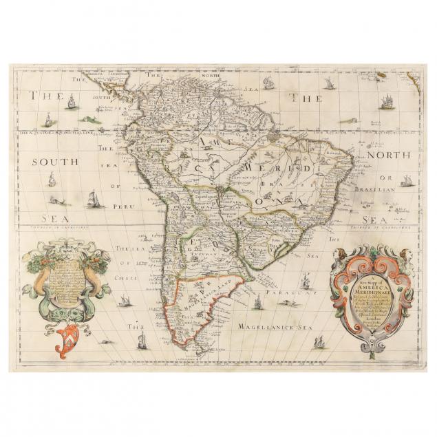
17th Century English Map of South America
Explore more items like this one.
Visit our Historical Department Historical
Lot Details & Additional Photographs
Image size 21 1/8 x 15 5/8 in.; frame dimensions 29 1/8 x 23 1/4 in.
Full margins, not laid down; light age toning, soiling, and offsetting; shallow fold creases with a small loss at center crease; light area of wear/soiling over the "T" at top right; not examined out of frame; a long but light scratch to glass; map in very good condition for its age.