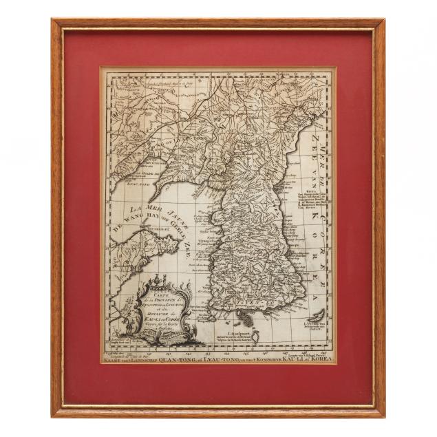
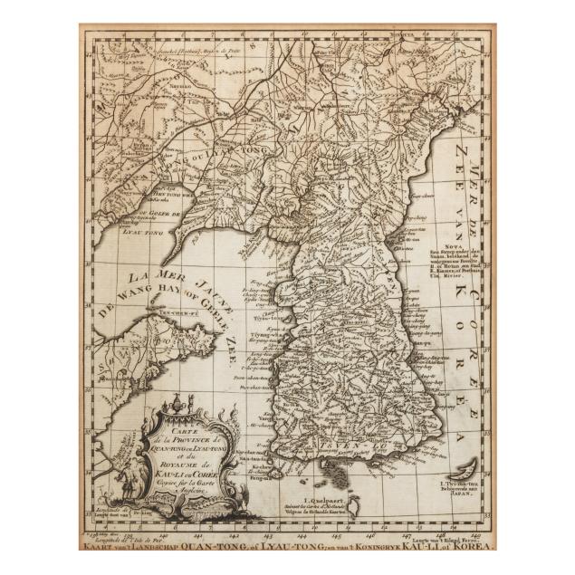
bellin-s-18th-century-map-of-korea
Lot 4018

Bellin's 18th-Century Map of Korea

Lot Details & Additional Photographs
Jacques-Nicolas Bellin. CARTE DE LA PROVINCE DE QUAN-TONG OU LYAU-TONG ET DU ROYAUME DE KAU-LI OU CORÉE COPIEE SUR LA CARTE ANGLOISE. Engraving by Jacob van der Schley, ca. 1750. The map depicts the Korean peninsula with the Yellow Sea and the "Mer de Coree" ("Sea of Korea"); with an elaborate title cartouche in the lower left corner; text in French and Dutch; watermark visible towards the center of the map; presented matted, under glass, and in a wooden frame.

15 X 12.5 in.; Image size 10 1/2 x 8 1/2 in.

Some toning, mostly at the top of the map and along the edges, and a few very minor spots; not examined out of frame. A nice example of this rather scarce map.