Lot 6074
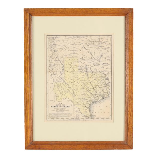
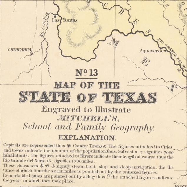
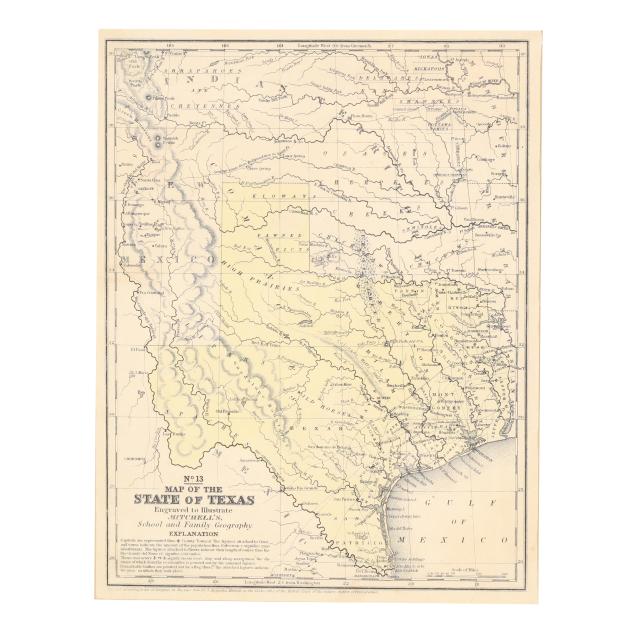
Mitchell's Map of the State of Texas (1846)
Explore more items like this one.
Visit our Historical Department Historical
Lot Details & Additional Photographs
Image size 10 3/8 x 7 7/8 in.; Frame dimensions 17 1/4 x 13 1/4 in.
A Private North Carolina Collection
A map of Texas soon after it became the 28th state in 1845, and published at the beginning of the Mexican-American War that started as a result of the annexation.
Lightly toned with a couple of small areas of staining/soiling, a few spots of foxing, and a tiny tear in the upper right corner; light wear to frame; not examined out of frame.