Lot 6097
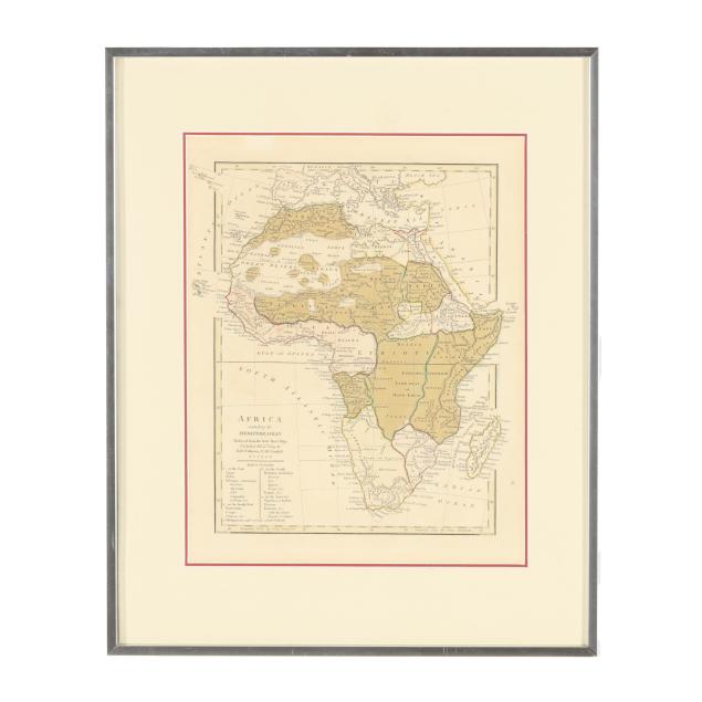
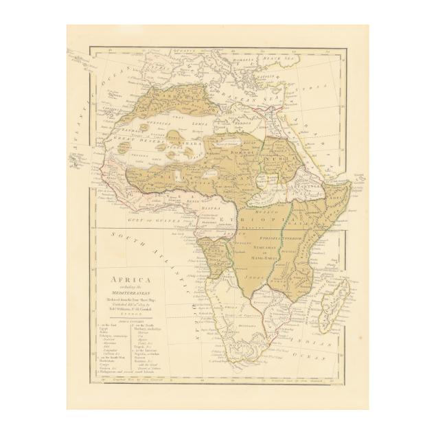
19th-Century Map of Africa
Explore more items like this one.
Visit our Historical Department Historical
Lot Details & Additional Photographs
Image size 11 1/8 x 10 1/4 in.; Frame dimensions 18 1/4 x 15 1/4 in.
A Private North Carolina Collection
Map with toning, a couple of light marks, mild creasing, and a few scattered spots of foxing; the mat with an area of soiling; light wear to frame; not examined outside the frame.