Lot 6067
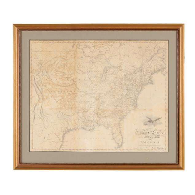
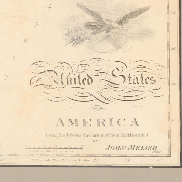
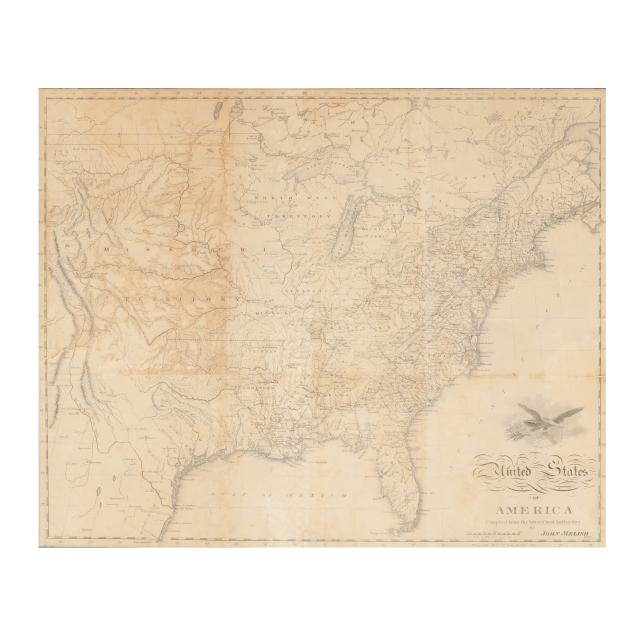
John Melish's Map of the United States
Explore more items like this one.
Visit our Historical Department Historical
Lot Details & Additional Photographs
Sight size 15 7/8 x 19 3/8 in.; Frame dimensions 20 3/4 x 24 in.
John Melish (1771-1822) was a mapmaker from Scotland who eventually settled in the United States and became well-known for his early maps of the United States.
Originally published in a book with associated fold lines and offsetting; some areas of separation at folds, a few chips and small tears mostly at margins, and one 4 3/4-in. tear; a couple of damp stains, the left margin trimmed, and light toning with uneven browning and discoloration; tape along upper margin; map attached to mat with tape at upper margin, not laid down.