large-french-sea-chart-of-the-saigon-river
Lot 6095

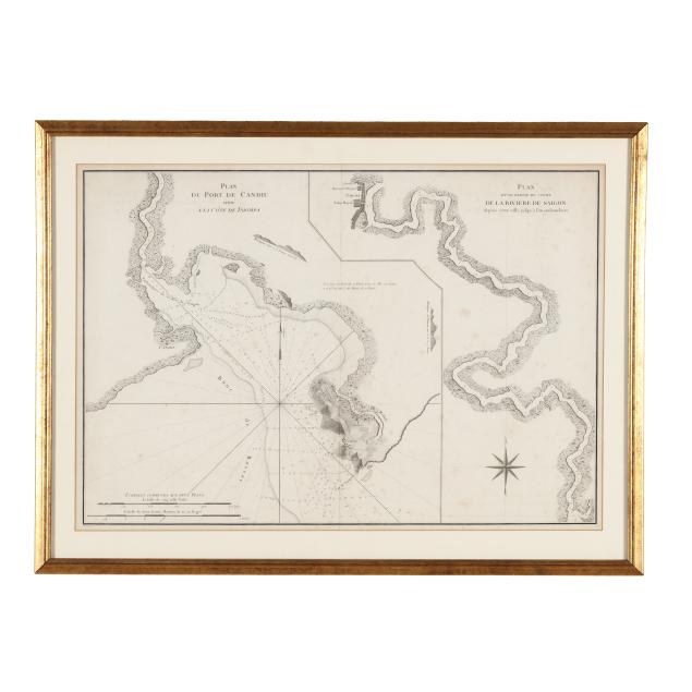
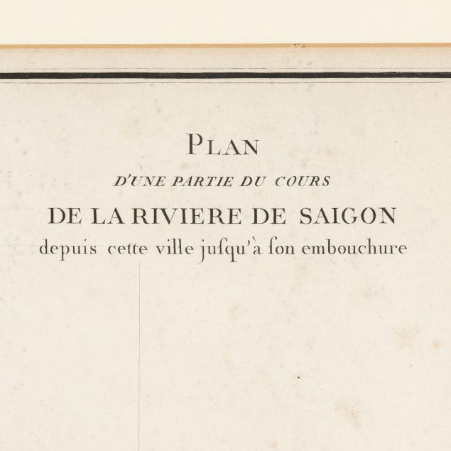
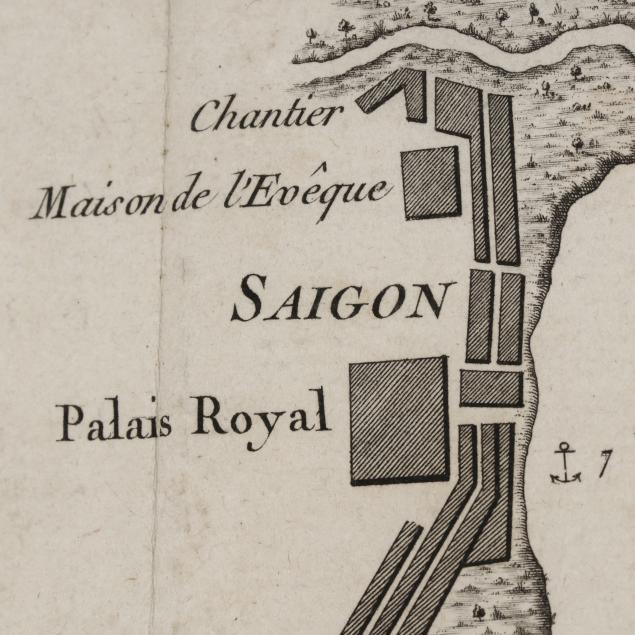
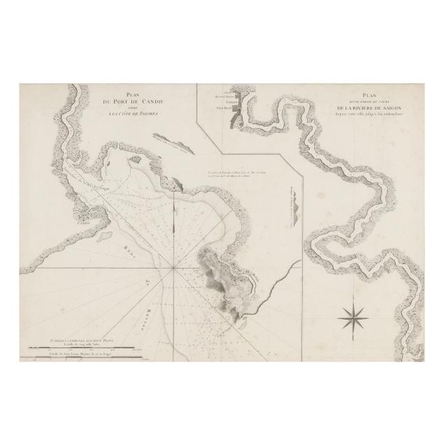
Large French Sea Chart of the Saigon River

Explore more items like this one.

Visit our Historical Department Historical
Lot Details & Additional Photographs
Dépôt Général de la Marine. PLAN DU PORT DE CANDIU SITUÉ A LA CÔTE DE TSIOMPA [with] PLAN D'UNE PARTIE DU COURS DE LA RIVIERE DE SAIGON DEPUIS CETTE VILLE JUSQU'À SON EMBOUCHURE. Paris: Dépôt Général de la Marine, circa 1800. Engraved by Croisey; the chart is presented in two sections; one part with the mouth of the Saigon River, the port of Candiu on the coast of Tsiompa (Champa), and down to Vũng Tàu which is labeled here "Cap St. Jasques" (Cap Saint-Jacques) as it was named by the French Indochinese government; the second part of the chart presenting the river flowing from Saigon (Ho Chi Minh City) with the royal palace labeled; well-presented matted and in a gilt wooden frame.

Image size 19 3/16 x 27 1/2 in.; Frame dimensions 24 3/8 x 32 1/2 in.

Collection of Mr. John Sylvester, Jr.

With central fold line, as issued, scattered foxing, very faint creasing, and some minor imperfections including a couple of tiny tears and an indentation; light wear to mat (a subtle stain and tiny tears); trivial wear to frame; not examined outside the frame; a lovely example.