Lot 6072
Three Maps of North and South Carolina
Explore more items like this one.
Visit our Historical Department Historical
Lot Details & Additional Photographs
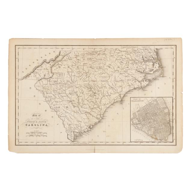
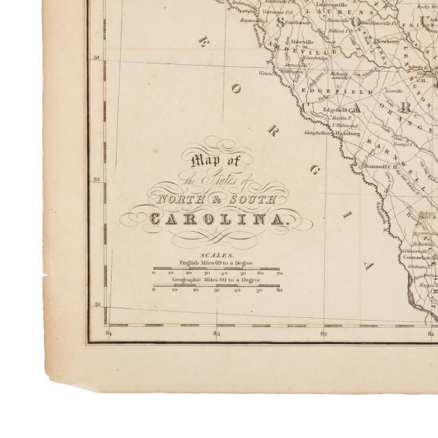
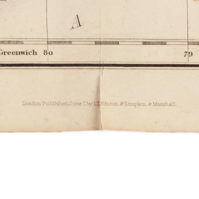
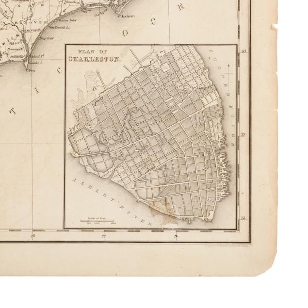
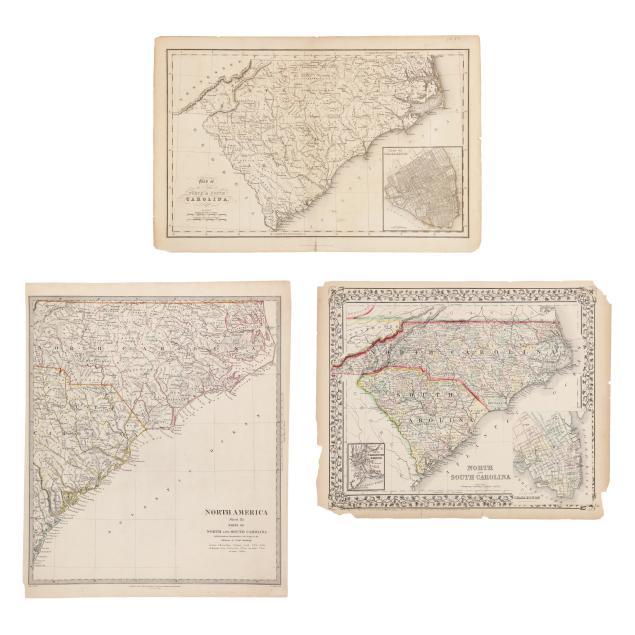
I[saac] T[aylor] Hinton, et al. MAP OF THE STATES OF NORTH & SOUTH CAROLINA. London: I.T. Hinton & Simpkin & Marshall, [1832]. Double-page map engraved and printed by Fenner Sears & Co.; with inset plan of Charleston and details such as towns, rivers, forts, mountain ranges, and more; an early map without full county configurations in the western part of the state; unframed. Sheet size 11 1/4 x 17 in. (Age toning, expected offsetting, a few creases and spots of foxing, two areas of residue, and wear in margins including chips and small tears not impacting the image; some wear to reinforcement at fold on verso with small areas of separation along the fold in the margins.)
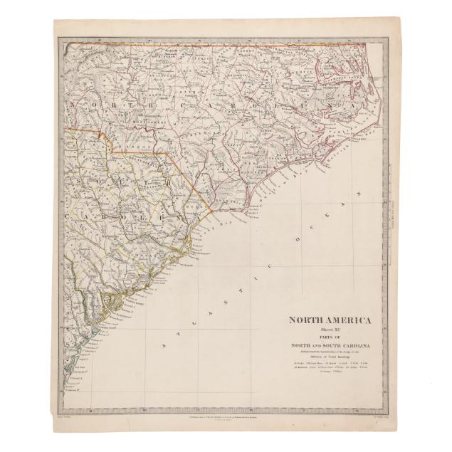
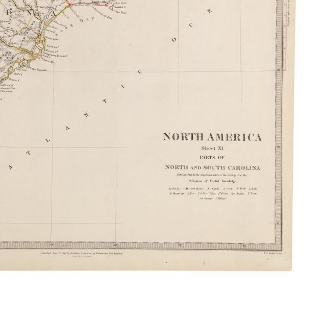
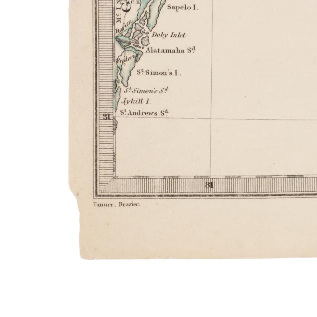
Society for the Diffusion of Useful Knowledge. NORTH AMERICA SHEET XI PARTS OF NORTH AND SOUTH CAROLINA. London: Baldwin & Cradock, 1833 (dated). Cartography by "Tanner. Brazier"; engraved by J. & C. Walker, with color outlines delineating counties and state lines; extremely detailed with towns, swamps, mountains, UNC Chapel Hill, and other features and landmarks labeled; unframed. Sheet size 16 1/4 x 13 5/8 in. (Light creasing, slight age toning, a few scattered spots of foxing, and some wear in the margins; overall a lovely example.)
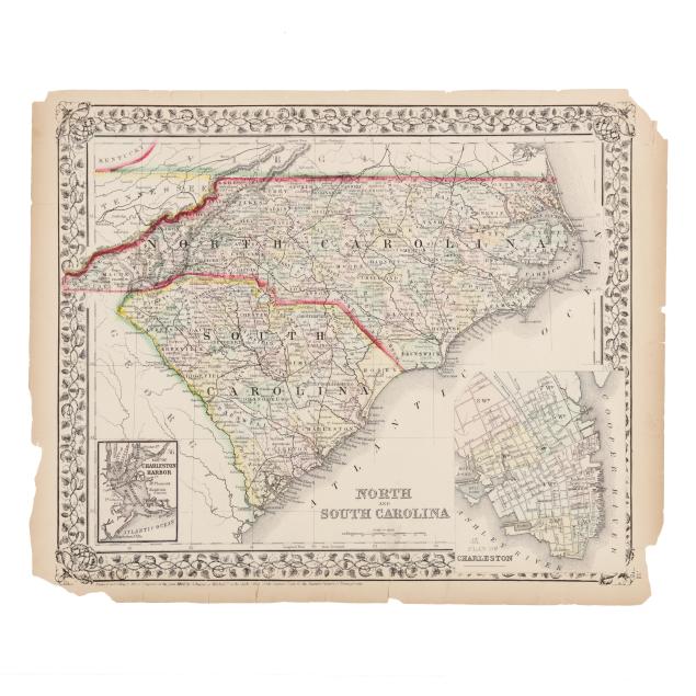
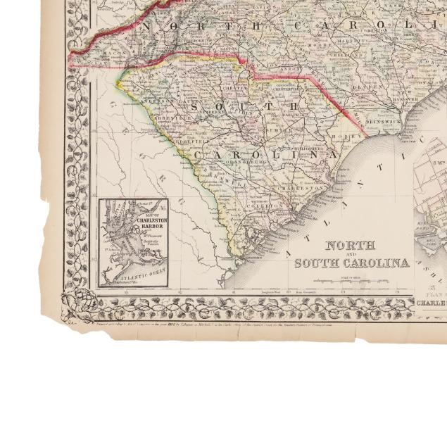
S[amuel] Augustus Mitchell. NORTH AND SOUTH CAROLINA. Philadelphia: S. Augustus Mitchell, 1870. From Mitchell's New General Atlas; an engraved map with hand-coloring and outlines distinguishing states and counties; with inset maps of Charleston Harbor and a plan of Charleston; unframed. Sheet size 12 3/8 x 15 1/4 in. (Age toning; map with minor marks and residue and a couple of very faint creases and spots of foxing; fairly heavy wear to margins occasionally impacting decorative border; verso with two pieces of tape and scattered light foxing.)
From a Private Outer Banks Collection
Per the consignor, previously part of the collection of Outer Banks historian, author, and realtor David Stick (1919-2009).