Lot 6071
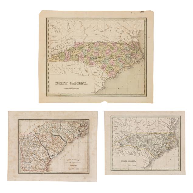
Thomas Gamaliel Bradford (1802-1887), Three Maps of the American South from the 1830s
Explore more items like this one.
Visit our Historical Department Historical
Lot Details & Additional Photographs
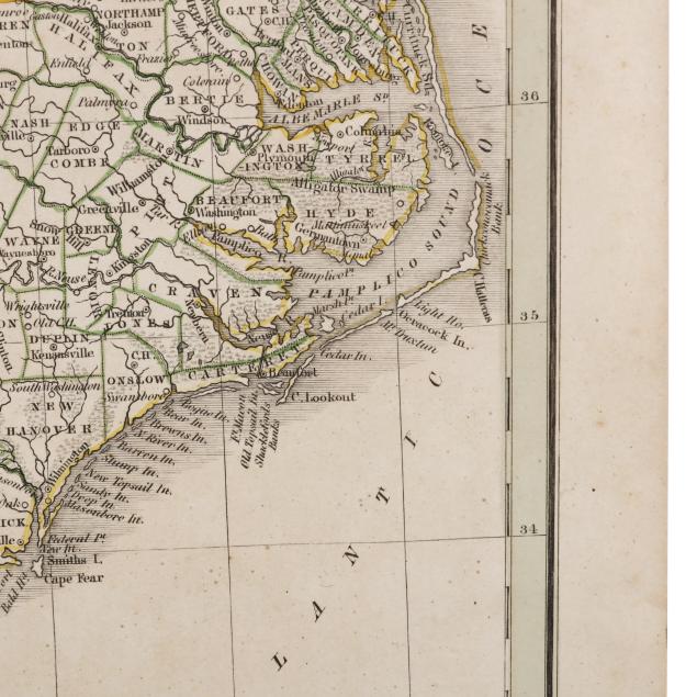
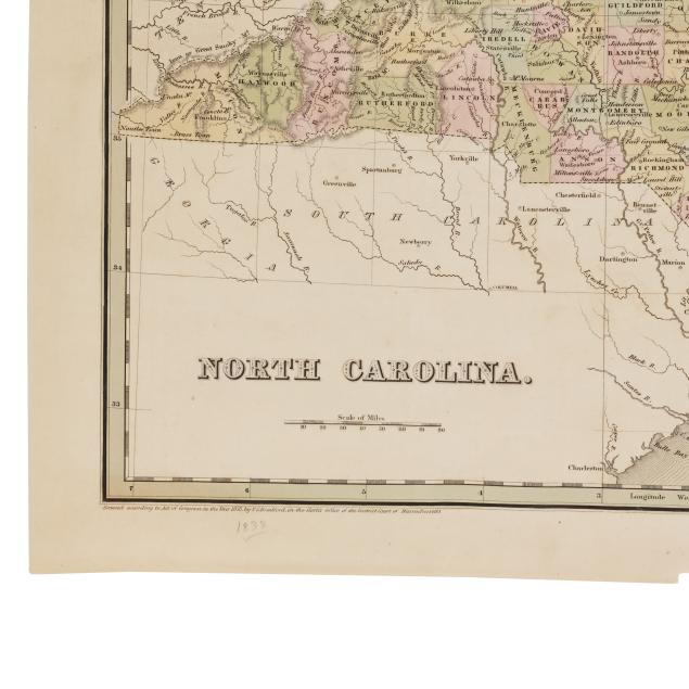
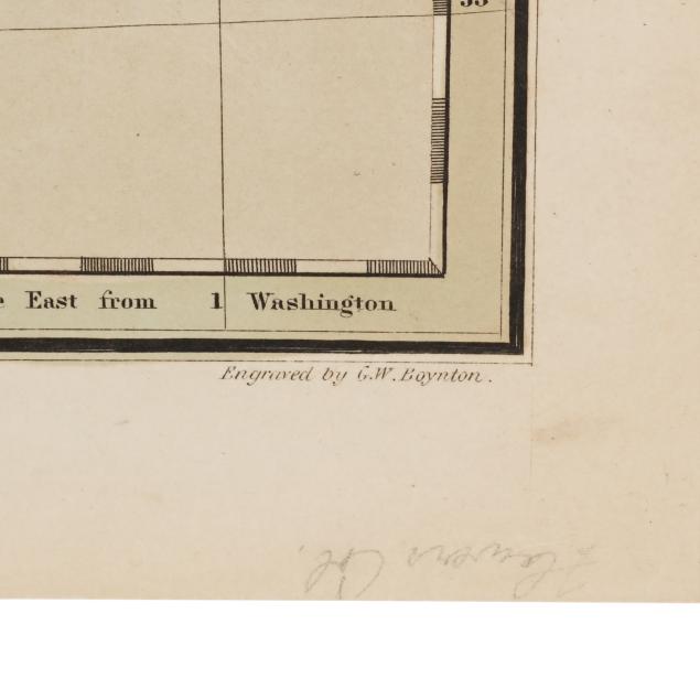
NORTH CAROLINA. Boston, 1838. From Bradford's An Illustrated Atlas...; engraved by G.W. Boynton; with green border, hand-colored counties, and parts of adjacent states; labeled with towns, rivers, swamps, and more, including Orange County with "Hillsboro," the Eno and Little Rivers, and University of N.C. Chapel Hill; unframed. Sheet size 13 1/8 x 16 3/8 in. (Light age toning, a few small creases, light foxing, some scattered marks mostly to verso, wear to two corners, and margins with a small loss, two tears impacting green border including one with taped repair to verso, and a small area of residue.)
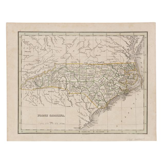
NORTH CAROLINA. Boston, [1835]. From Bradford's Comprehensive Atlas; engraved by Morse & Tuttle; with green border and color outlines distinguishing counties; unframed. Sheet size 9 3/16 x 11 9/16 in. (Light age toning, scattered foxing, and minor finger grime.)
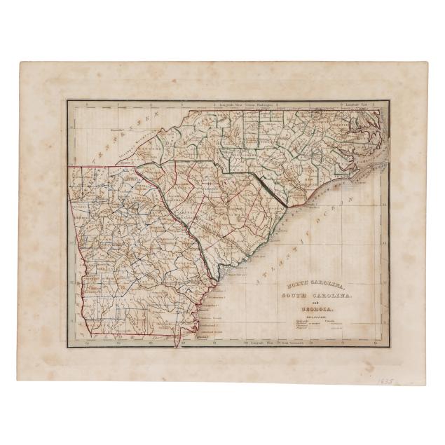
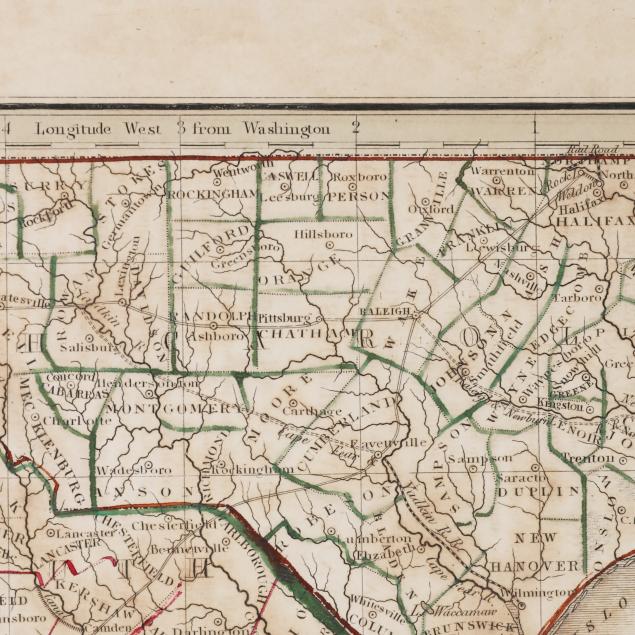
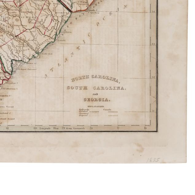
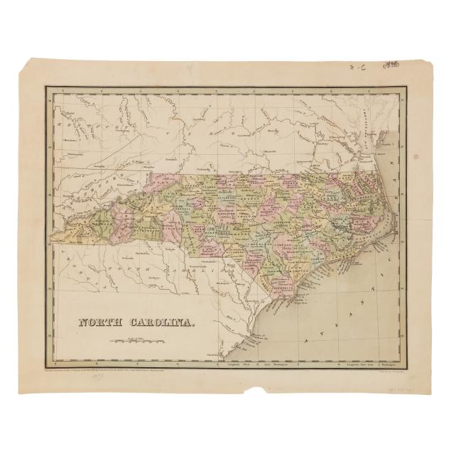
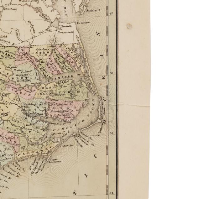
NORTH CAROLINA, SOUTH CAROLINA, AND GEORGIA. Boston, [1835]. From Bradford's Comprehensive Atlas; engraved map with green border, and hand-color outlines distinguishing counties, as well as details such as towns, counties, rivers, railroads, and more; unframed. Sheet size 10 x 12 3/4 in. (Light age toning, scattered foxing, a couple of stains in the margins, expected offsetting, minor edge wear, and one fairly subtle area of tearing at the border; wide margins.)
From a Private Outer Banks Collection
Per the consignor, previously part of the collection of Outer Banks historian, author, and realtor David Stick (1919-2009).