Lot 3013
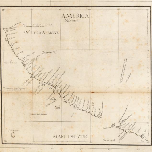
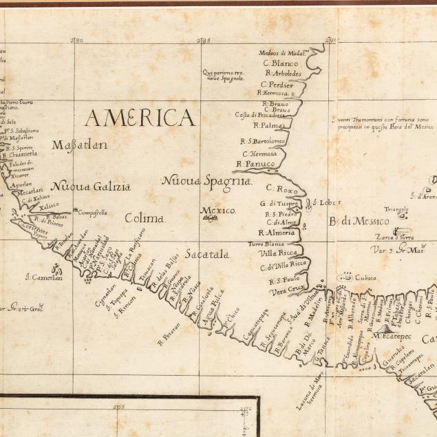
Sir Robert Dudley (1574-1649), Extremely Scarce First Edition of the First Sea Chart Focused on California
Explore more items like this one.
Visit our Historical Department Historical
Lot Details & Additional Photographs
Sight size 18 1/4 x 27 1/4 in.; Sheet size 19 1/2 x 28 3/4 in. (at widest); Frame dimensions 26 x 34 3/4 in.
From the Collection of Priscilla Schavran, Holly Springs, North Carolina
Sir Robert Dudley was an English cartographer, explorer, and ship builder, and the son of the 1st Earl of Leicester. He settled in Florence, Italy, where he worked for most of his life, and in his 70s he published the Arcano del Mare (The Secret of the Sea), the first sea atlas to include the entire globe. Unique and important in many ways, his atlas is especially well-known for the time-consuming and spectacular engraved charts by Lucini with engravings that Burden states "represent the finest of Italian capabilities." Burden notes, too, that the atlas was "the first printed English nautical atlas," "[a]rguably the most sumptuous ever produced," and that it "was the first atlas to use Mercator's projection throughout, and the earliest to show the prevailing winds, currents and magnetic deviation."
Burden also explains the undeniable importance of this particular map: "This is the first printed sea chart of the Californian coastline and draws upon the voyage of Sebastián Vizcaino in 1602.... It was to be the last voyage for sometime to explore this coast; its most important development was the name of Monterey, Pº: di Moneerei" (The Mapping of North America, pgs. 338-339).
Two sheets joined as one, as issued; sheet with foxing; vertical and horizontal fold lines, including one horizontal fold with areas of separation, small chips, a few small damp stains, and browning; tear from left margin just merging into border of inset map; minor creasing; a study of the verso shows margins trimmed short with a portion of the left margin left wide; attached at upper edge with two strips of tape on verso; not laid down.