Lot 3110
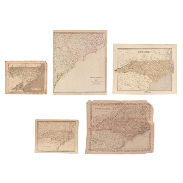
Five 19th-Century Maps of North Carolina
Explore more items like this one.
Visit our Historical Department Historical
Lot Details & Additional Photographs
S[amuel] Lewis. NORTH CAROLINA. Boston, circa 1812. From Aaron Arrowsmith's and Samuel Lewis's A New and Elegant General Atlas. Drawn by Lewis and engraved by Tanner. With inset map of "Western Part of North Carolina continued" and simple title cartouche. Sheet size 9 1/8 x 11 1/4 in. (Foxing and toning; map with light creasing and a couple of minor stains and spots of residue; writing in margin and on verso; various signs of wear to edges and margins.)
Society for the Diffusion of Useful Knowledge. NORTH AMERICA SHEET XI PARTS OF NORTH AND SOUTH CAROLINA. London: Baldwin & Cradock, 1833 (dated). Cartography by "Tanner. Brazier"; engraved by J. & C. Walker, with color outlines delineating counties and state lines. Sheet size 16 1/8 x 13 3/8 in. (Light creasing, slight age toning and light scattered foxing (heavier on verso), a few minor marks and stains, left margin trimmed, and some wear in the margins including a small tear entering the border; overall a good example.)
Thomas Gamaliel Bradford. NORTH CAROLINA. Boston, circa 1835. From Bradford's Comprehensive Atlas; engraved by Morse & Tuttle; with green border and color outlines. Sheet size 9 x 11 3/8 in. (Light age toning and offsetting; mild wear at edges and margins; light scattered foxing to verso.)
Sydney E. Morse and Samuel Breese. NORTH CAROLINA. New York: Harper & Brothers, [1845]. Colored wax-engraved map from Morse's North American Atlas, one of the first to use the cerographic printing process. Sheet size 14 x 17 7/8 in. (Minor creasing; margins with light foxing, mild edge wear, and a corner fold; a lovely example.)
G. W. Colton. COLTON'S NORTH CAROLINA. New York: G.W. and C.B. Colton, circa 1874. A detailed map from Colton's General Atlas; with hand-colored outline and coloring by county, decorative border, and inset map of Beaufort; text "States of Central America" on verso. Sheet size 14 x 17 3/8 in. (General age and handling wear mostly in margins, and with several large tears; fair condition only.)
From a Private Outer Banks Collection
Per the consignor, previously part of the collection of Outer Banks historian, author, and realtor David Stick (1919-2009).


