Lot 3072
Two Detailed Maps from the Atlas to Accompany the Official Records of the Union and Confederate Armies
Explore more items like this one.
Visit our Historical Department Historical
Lot Details & Additional Photographs
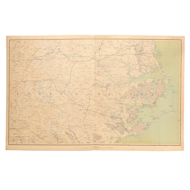
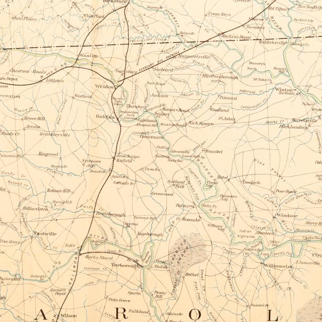
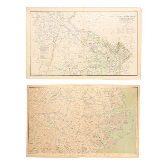
U.S. War Department. [North Carolina]. GENERAL TOPOGRAPHICAL MAP. SHEET III. PLATE CXXXVIII. From Atlas to Accompany the Official Records of the Union and Confederate Armies. 1861-1865. (Washington, 1891-1895). Lithographed by Julies Bien & Co., New York. Presenting a detailed map of North Carolina with parts of Virginia and South Carolina. (18 x 28 3/8 in.) (Toning, image transfer, minor creasing, rare spot of foxing (mostly to verso), and wear at margins including minor grime, a couple of subtle damp stains, some small chips and closed tears (a few impacting title), a small area of separation at the centerfold, and two professionally repaired tears.)
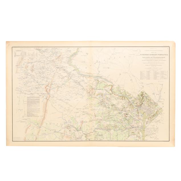
U.S. War Department. SHEET 1. SURVEYS FOR MILITARY DEFENSES. MAP OF NORTHEASTERN VIRGINIA AND VICINITY OF WASHINGTON. PLATE VII. From Atlas to Accompany the Official Records of the Union and Confederate Armies. 1861-1865. (Washington, 1891-1895). Lithographed by Julies Bien & Co., New York. (18 1/4 x 29 1/8 in.) (Light toning at margins and centerfold, minor grime and image transfer, a few areas of creasing, and some wear at margins.)