Lot 3068
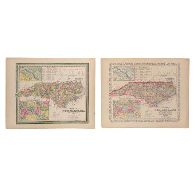
Two Editions of A New Map of Nth. Carolina with its Canals, Roads & Distances From the 1850s
Explore more items like this one.
Visit our Historical Department Historical
Lot Details & Additional Photographs
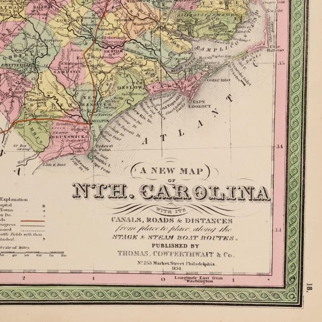
Thomas, Cowperthwait & Co. A NEW MAP OF NTH. CAROLINA WITH ITS CANALS, ROADS & DISTANCES FROM PLACE TO PLACE, ALONG THE STAGE & STEAM BOAT ROUTES. Philadelphia: Thomas, Cowperthwait & Co., dated 1854. (13 1/2 x 17 in.) (A few subtle spots of foxing, mild toning, and light wear to margins.)
Charles Desilver. A NEW MAP OF NTH. CAROLINA WITH ITS CANALS, ROADS & DISTANCES FROM PLACE TO PLACE, ALONG THE STAGE & STEAM BOAT ROUTES. Philadelphia, [1857]. (13 3/4 x 17 1/4 in.) (Presented with a mat, not attached; with mild toning, light scattered foxing, minor soiling, and wear in the margins including slight edge wear, and offsetting and marks mostly in upper margin but lightly impacting profile of the swamp.)
A Private High Point, North Carolina Collection