Lot 4206
Early-19th-Century Reproductions of Two Important John Smith Maps
Explore more items like this one.
Visit our Historical Department Historical
Lot Details & Additional Photographs
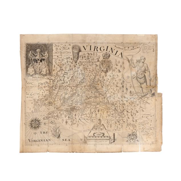
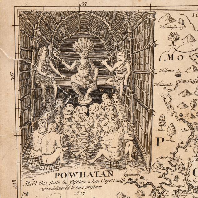
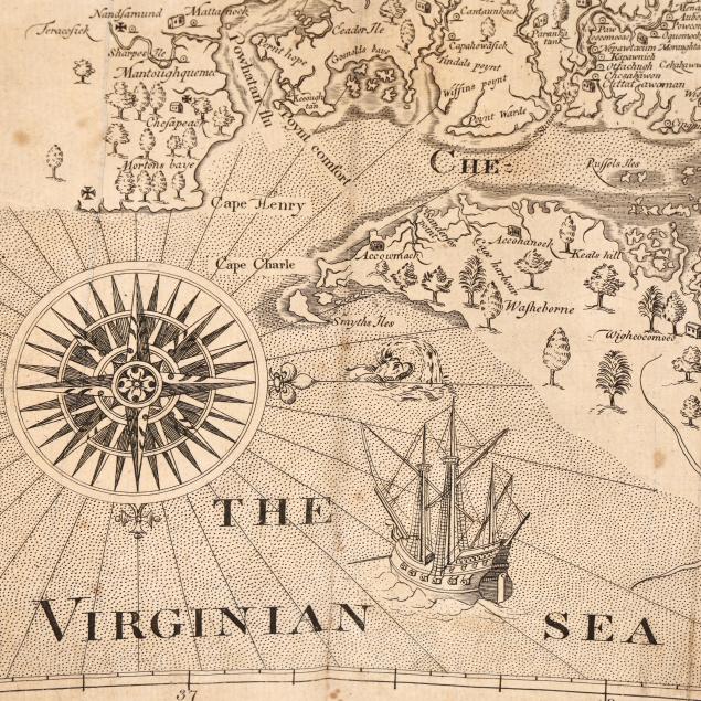
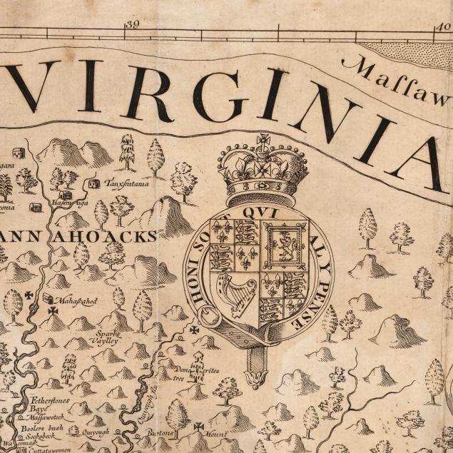
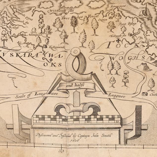
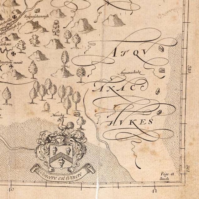
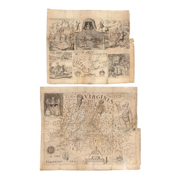
VIRGINIA. DISCOVERED AND DESCRIBED BY CAPTAYN JOHN SMITH. 1606. Facsimile from State 10 of the map. "One of the most important printed maps of America ever produced and certainly one of the greatest influence." (Burden, p. 202) (14 3/8 x 17 1/8 in.)
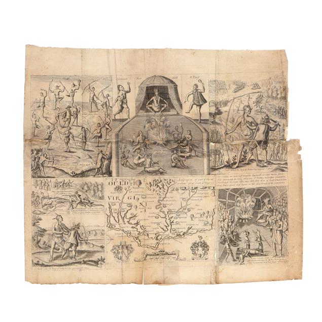
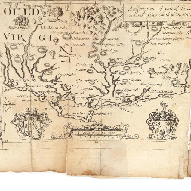
OULD VIRGINIA. A DESCRIPTION OF PART OF THE ADVENTURES OF CAP SMITH IN VIRGINIA. With map at lower center and surrounding scenes of John Smith in America in 1607-1609. Facsimile from State 4 of the map. (12 7/8 x 15 3/8 in.)
Sabin 82852; Burden 164 and 212.
Private Collection, Portsmouth, Virginia
Both with folds, as issued, with some additional creasing, as well as light scattered foxing, toning, areas of separation at folds, light grime, scattered chips (mostly at margins) and tears, loss at right margin from being removed from the book, and a few small insect holes; Virginia with areas of discoloration, and scattered repairs including a partial repair to a loss at upper left, a 2 1/4-in repaired tear at right, and two patches on verso; Ould Virginia with a few small scattered stains, a small repaired tear in the margin, and numerous patches to verso (most along horizontal fold), with overall heavier wear including the largest tear (4 1/2 in.) at a vertical fold.