Lot Details & Additional Photographs
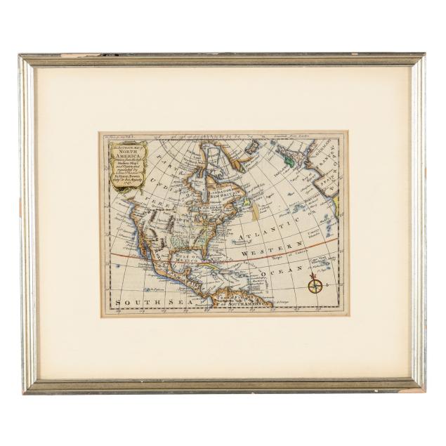
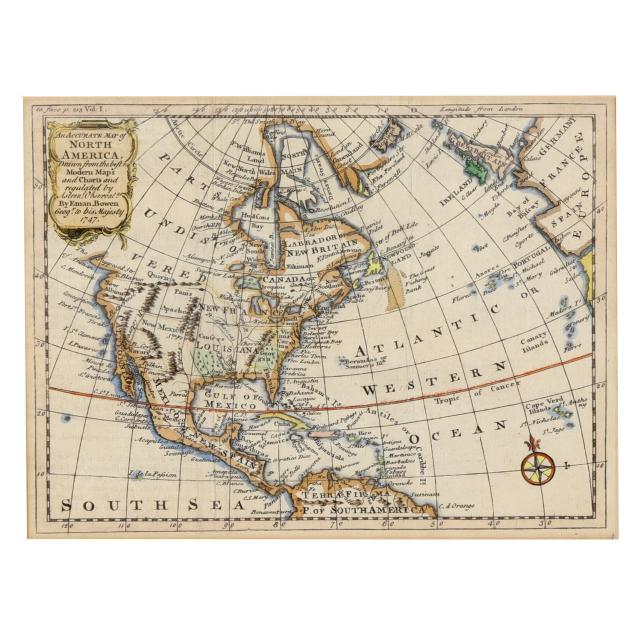
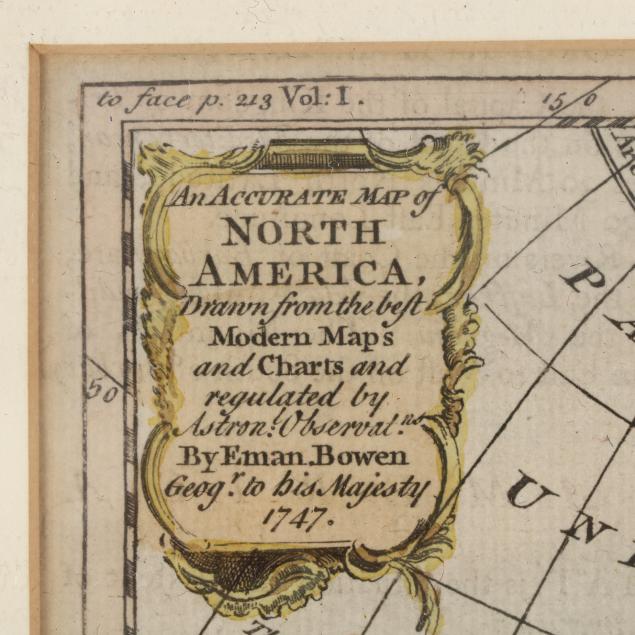
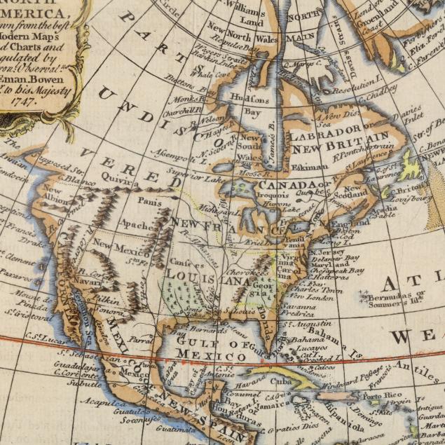
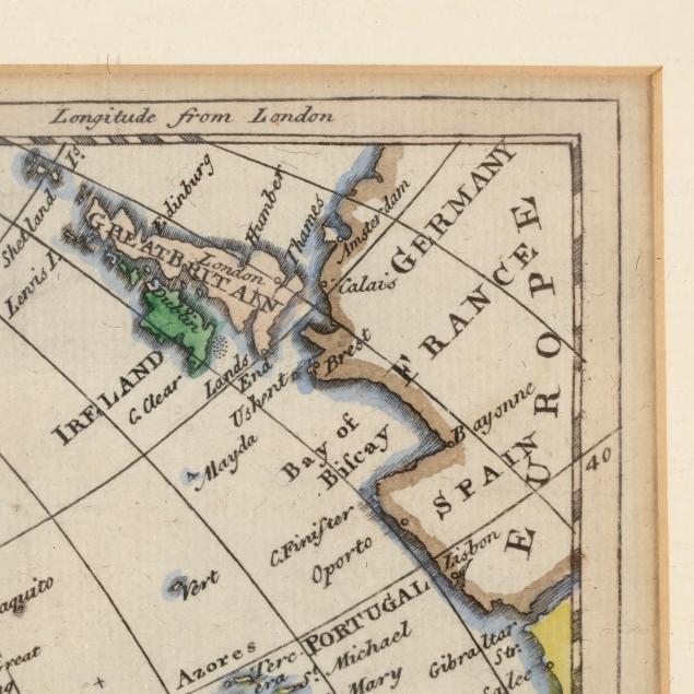
Eman[uel] Bowen. AN ACCURATE MAP OF NORTH AMERICA, DRAWN FROM THE BEST MODERN MAPS AND CHARTS AND REGULATED BY ASTRONL OBSERVATNS. London, 1747. Engraved map with hand coloring; with decorative title cartouche and a compass rose; presenting colonial North America with "Parts Undiscovered" in western Canada, "New Albion" in northern California, the American colonies named along with major cities along the East Coast, and many other details such as the location of several Native American tribes; displayed matted and framed.
Sight size 6 1/4 x 8 3/8 in.; Frame dimensions 11 1/2 x 13 5/8 x 5/8 in.
Emanuel Bowen (1694-1767) was a Welsh map engraver who worked as Royal Mapmaker to King George II and Louis XV.
Vertical creasing, a minor area of separation at one fold, toning to outer edge of mat; some wear to frame; not examined outside the frame.